- 7.1 km
- 35 m
- 32 m
- Fengyuan, Taiwan, Taiwan
苗栗縣鄉道54全覽
A cycling route starting in Fengyuan, Taiwan, Taiwan.
Overview
About this route
Route Miao 54 connects the Pinglin road with Taiwan's Route 3. The Shuiliudong road to the east roughly follows the boundary between Zhuolan Town (Jingshan Village) and Dahu Township (Wurong Village), with a road leading to Jingshan Elementary School. The entire route is mostly dual carriageway, and the road conditions are good.
- -:--
- Duration
- 4.5 km
- Distance
- 133 m
- Ascent
- 209 m
- Descent
- ---
- Avg. speed
- ---
- Max. altitude
created this 15 years ago
Route quality
Waytypes & surfaces along the route
Waytypes
Road
3.8 km
(85 %)
Access road
0.6 km
(13 %)
Undefined
0.1 km
(2 %)
Surfaces
Paved
3.9 km
(87 %)
Asphalt
3.9 km
(87 %)
Undefined
0.6 km
(13 %)
Route highlights
Points of interest along the route

Photo after 0 km
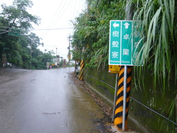
苗54終點里程牌

Point of interest after 0 km
位在苗55之苗54指示牌,直行往上(朝南宮)為苗54

Photo after 0.8 km
高點觀景台

Photo after 0.9 km
觀景台展望

Photo after 1 km

Point of interest after 1.1 km
左轉(南向)往景山國小

Photo after 1.4 km
斷橋橋墩,待查

Photo after 1.7 km

Photo after 2.1 km

Photo after 2.1 km
觀景台

Photo after 2.2 km
往前(西向)照接下來的路

Photo after 3.9 km
來時路況,兩側梨園

Point of interest after 4.4 km
苗54起點,約位於台3之139.1k
Continue with Bikemap
Use, edit, or download this cycling route
You would like to ride 苗栗縣鄉道54全覽 or customize it for your own trip? Here is what you can do with this Bikemap route:
Free features
- Save this route as favorite or in collections
- Copy & plan your own version of this route
- Sync your route with Garmin or Wahoo
Premium features
Free trial for 3 days, or one-time payment. More about Bikemap Premium.
- Navigate this route on iOS & Android
- Export a GPX / KML file of this route
- Create your custom printout (try it for free)
- Download this route for offline navigation
Discover more Premium features.
Get Bikemap PremiumFrom our community
Other popular routes starting in Fengyuan
- 高美濕地 20220822 Gaomei wetland
- 20251119 潭雅神 六寶公園
- 13.3 km
- 65 m
- 66 m
- Fengyuan, Taiwan, Taiwan
- 2015.2.27-(苗栗)-薑麻園一日遊
- 42.5 km
- 854 m
- 854 m
- Fengyuan, Taiwan, Taiwan
- 20251210 戰車公園 post 希望滿人權
- 14.9 km
- 68 m
- 68 m
- Fengyuan, Taiwan, Taiwan
- 台中清水公園土地公鐵塔
- 5.7 km
- 226 m
- 178 m
- Fengyuan, Taiwan, Taiwan
- 鐵砧山休閒騎
- 2.3 km
- 199 m
- 44 m
- Fengyuan, Taiwan, Taiwan
- 東豐綠廊 20220914 DongFeng bikeway
- 23.1 km
- 270 m
- 269 m
- Fengyuan, Taiwan, Taiwan
- 后里賞櫻遊
- 57.4 km
- 814 m
- 1,048 m
- Fengyuan, Taiwan, Taiwan
Open it in the app


