

Teststrecke mit POIs
A cycling route starting in Sachsenburg, Carinthia, Austria.
Overview
About this route
- -:--
- Duration
- 0.7 km
- Distance
- 4 m
- Ascent
- 0 m
- Descent
- ---
- Avg. speed
- ---
- Max. altitude

Route quality
Waytypes & surfaces along the route
Waytypes
Quiet road
0.7 km
(100 %)
Surfaces
Paved
0.7 km
(100 %)
Asphalt
0.7 km
(100 %)
Route highlights
Points of interest along the route

Point of interest after 0.2 km
aoaoaoao

Photo after 0.4 km
photoooo

Bike service after 0.5 km
service bike
Drinking water after 0.7 km
drink water

Accommodation after 0.7 km
sleeping fine
Continue with Bikemap
Use, edit, or download this cycling route
You would like to ride Teststrecke mit POIs or customize it for your own trip? Here is what you can do with this Bikemap route:
Free features
- Save this route as favorite or in collections
- Copy & plan your own version of this route
- Sync your route with Garmin or Wahoo
Premium features
Free trial for 3 days, or one-time payment. More about Bikemap Premium.
- Navigate this route on iOS & Android
- Export a GPX / KML file of this route
- Create your custom printout (try it for free)
- Download this route for offline navigation
Discover more Premium features.
Get Bikemap PremiumFrom our community
Other popular routes starting in Sachsenburg
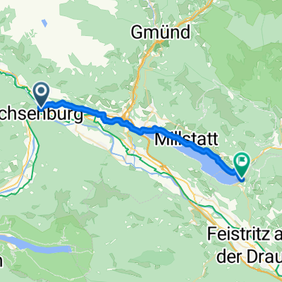
 A - Drau-Radweg-3 - Möllbrücke-Villach - 54 km
- Distance
- 53.5 km
- Ascent
- 143 m
- Descent
- 211 m
- Location
- Sachsenburg, Carinthia, Austria
 Mi6 Möllnbrücke - Oberdrauburg 43km 290HM ZUG
- Distance
- 43.9 km
- Ascent
- 515 m
- Descent
- 450 m
- Location
- Sachsenburg, Carinthia, Austria
 Steinfeld - Spittal an der Drau + Spittal an der Drau - Fresach + Fresach - Villach
- Distance
- 27.2 km
- Ascent
- 402 m
- Descent
- 379 m
- Location
- Sachsenburg, Carinthia, Austria
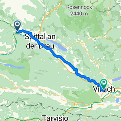 Möllbrücke - Villach
- Distance
- 52.7 km
- Ascent
- 355 m
- Descent
- 426 m
- Location
- Sachsenburg, Carinthia, Austria
 Drau3
Drau3- Distance
- 56.6 km
- Ascent
- 145 m
- Descent
- 180 m
- Location
- Sachsenburg, Carinthia, Austria
 Spittal - Salzkofelhütte -Spittal
- Distance
- 29.8 km
- Ascent
- 1,459 m
- Descent
- 1,477 m
- Location
- Sachsenburg, Carinthia, Austria
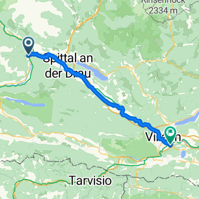 Marktplatz, Sachsenburg - Villach
- Distance
- 57.9 km
- Ascent
- 406 m
- Descent
- 472 m
- Location
- Sachsenburg, Carinthia, Austria
 WS Mittwoch ab Möllbrücke 35KM GH Kreinerhof nach 34km 290HM
- Distance
- 35.8 km
- Ascent
- 261 m
- Descent
- 262 m
- Location
- Sachsenburg, Carinthia, Austria
Open it in the app