

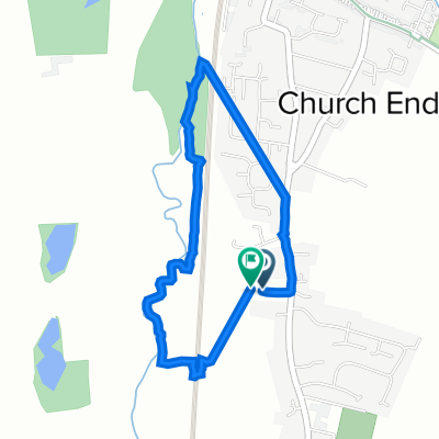
Langford, champneys loop
A cycling route starting in Arlesey, England, United Kingdom.
Overview
About this route
- 1 h 16 min
- Duration
- 12.2 km
- Distance
- 48 m
- Ascent
- 45 m
- Descent
- 9.7 km/h
- Avg. speed
- ---
- Max. altitude

Route quality
Waytypes & surfaces along the route
Waytypes
Cycleway
2.8 km
(23 %)
Quiet road
2.7 km
(22 %)
Surfaces
Paved
1.7 km
(14 %)
Unpaved
3.2 km
(26 %)
Ground
2.8 km
(23 %)
Asphalt
1.7 km
(14 %)
Continue with Bikemap
Use, edit, or download this cycling route
You would like to ride Langford, champneys loop or customize it for your own trip? Here is what you can do with this Bikemap route:
Free features
- Save this route as favorite or in collections
- Copy & plan your own version of this route
- Sync your route with Garmin or Wahoo
Premium features
Free trial for 3 days, or one-time payment. More about Bikemap Premium.
- Navigate this route on iOS & Android
- Export a GPX / KML file of this route
- Create your custom printout (try it for free)
- Download this route for offline navigation
Discover more Premium features.
Get Bikemap PremiumFrom our community
Other popular routes starting in Arlesey
 Chase Hill Road 107 to Chase Hill Road 107
- Distance
- 12.3 km
- Ascent
- 54 m
- Descent
- 50 m
- Location
- Arlesey, England, United Kingdom
 45 Lymans Road, Arlesey to Holme Mills, Langford Road, Biggleswade
- Distance
- 11.4 km
- Ascent
- 0 m
- Descent
- 10 m
- Location
- Arlesey, England, United Kingdom
 1B Chapel Dr, Arlesey to Old Oak Close, Arlesey
- Distance
- 2.3 km
- Ascent
- 4 m
- Descent
- 8 m
- Location
- Arlesey, England, United Kingdom
 Bates Avenue 17 to Bates Avenue 19
- Distance
- 2.8 km
- Ascent
- 60 m
- Descent
- 60 m
- Location
- Arlesey, England, United Kingdom
 Bates Avenue 19 to Bates Avenue 19
- Distance
- 4.2 km
- Ascent
- 59 m
- Descent
- 105 m
- Location
- Arlesey, England, United Kingdom
 Langford, champneys loop
- Distance
- 12.2 km
- Ascent
- 48 m
- Descent
- 45 m
- Location
- Arlesey, England, United Kingdom
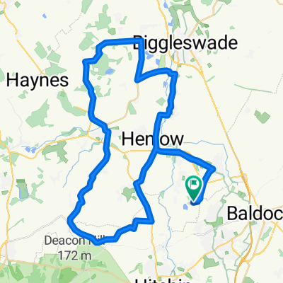 Fairfield West - 34m
- Distance
- 54.8 km
- Ascent
- 151 m
- Descent
- 154 m
- Location
- Arlesey, England, United Kingdom
 Bates Avenue 19 to Bates Avenue 19
- Distance
- 3.9 km
- Ascent
- 13 m
- Descent
- 59 m
- Location
- Arlesey, England, United Kingdom
Open it in the app