

Ze St.Martin do údolí Neubachtal,přes Lammertal zpět
A cycling route starting in Eben im Pongau, Salzburg, Austria.
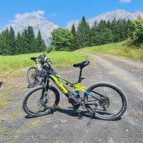
Overview
About this route
The route is slightly hilly, the second part from Lammertal is a more challenging climb, rewarded with beautiful views.
- -:--
- Duration
- 22.6 km
- Distance
- 508 m
- Ascent
- 508 m
- Descent
- ---
- Avg. speed
- ---
- Max. altitude
Route quality
Waytypes & surfaces along the route
Waytypes
Quiet road
10.2 km
(45 %)
Track
4.3 km
(19 %)
Surfaces
Paved
17 km
(75 %)
Unpaved
1.8 km
(8 %)
Asphalt
17 km
(75 %)
Gravel
1.8 km
(8 %)
Undefined
3.8 km
(17 %)
Route highlights
Points of interest along the route

Photo after 6.9 km

Photo after 11.9 km
do údolí Neubachtal

Photo after 14.9 km
výhled na Bischofsmütze

Photo after 15.7 km
výhled na Dachstein

Photo after 17.1 km
v pozadí Dachstein

Photo after 19.8 km
Dachstein

Photo after 19.9 km
Dachstein

Photo after 20.6 km
v údolí St.Martin

Photo after 22.1 km
St.Martin
Continue with Bikemap
Use, edit, or download this cycling route
You would like to ride Ze St.Martin do údolí Neubachtal,přes Lammertal zpět or customize it for your own trip? Here is what you can do with this Bikemap route:
Free features
- Save this route as favorite or in collections
- Copy & plan your own version of this route
- Sync your route with Garmin or Wahoo
Premium features
Free trial for 3 days, or one-time payment. More about Bikemap Premium.
- Navigate this route on iOS & Android
- Export a GPX / KML file of this route
- Create your custom printout (try it for free)
- Download this route for offline navigation
Discover more Premium features.
Get Bikemap PremiumFrom our community
Other popular routes starting in Eben im Pongau
 Rossbrandrunde
- Distance
- 35 km
- Ascent
- 1,414 m
- Descent
- 1,414 m
- Location
- Eben im Pongau, Salzburg, Austria
 1205 St.Martin - údoli Bluntautal
- Distance
- 42.5 km
- Ascent
- 155 m
- Descent
- 633 m
- Location
- Eben im Pongau, Salzburg, Austria
 Ze St.Martin do údolí Neubachtal,přes Lammertal zpět
- Distance
- 22.6 km
- Ascent
- 508 m
- Descent
- 508 m
- Location
- Eben im Pongau, Salzburg, Austria
 Aualm 1
- Distance
- 11 km
- Ascent
- 487 m
- Descent
- 268 m
- Location
- Eben im Pongau, Salzburg, Austria
 Reitlehenalm von Eben aus
- Distance
- 14.4 km
- Ascent
- 722 m
- Descent
- 720 m
- Location
- Eben im Pongau, Salzburg, Austria
 Flachauwinkelrunde XL
- Distance
- 36.7 km
- Ascent
- 873 m
- Descent
- 861 m
- Location
- Eben im Pongau, Salzburg, Austria
 Ze St.Martin přes Jagersee do Wagrain
- Distance
- 63.3 km
- Ascent
- 918 m
- Descent
- 1,017 m
- Location
- Eben im Pongau, Salzburg, Austria
 Reitlehenalm
- Distance
- 18.6 km
- Ascent
- 662 m
- Descent
- 662 m
- Location
- Eben im Pongau, Salzburg, Austria
Open it in the app