

T-R - St-Étienne - Louiseville (B)
A cycling route starting in Trois-Rivières, Quebec, Canada.
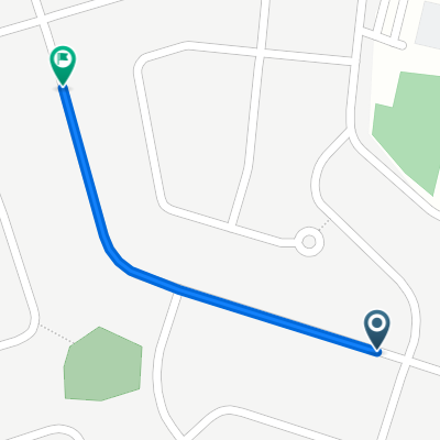
Overview
About this route
Beautiful route, there are some good climbs but the flats and the scenery quickly make us forget them.
- -:--
- Duration
- 94 km
- Distance
- 188 m
- Ascent
- 191 m
- Descent
- ---
- Avg. speed
- ---
- Max. altitude

Route quality
Waytypes & surfaces along the route
Waytypes
Road
59.2 km
(63 %)
Quiet road
5.6 km
(6 %)
Surfaces
Paved
51.7 km
(55 %)
Asphalt
51.7 km
(55 %)
Undefined
42.3 km
(45 %)
Route highlights
Points of interest along the route
Point of interest after 23.4 km
Banc de repos mais sans toilettes ni eau.
Point of interest after 33.7 km
Il y a en parc avec banc pour se reposer, en face petite rue avec parc et toilettes chimiques.
Point of interest after 48.5 km
Beau point de vue (Pont et rivières) dommage qu'il n'y ait pas de parc...
Point of interest after 54.6 km
Beau parc sur le coin de la rue, très passant donc bruyant.
Point of interest after 65.6 km
Yamachiche, parc avec toilettes chimiques, parfois elles sont dans le parc des enfants ou près de la batisse.
Point of interest after 78 km
Halte, eau, toilette et à espérer encore cette année un petit restaurant où l'on peut manger dehors.
Point of interest after 78.6 km
Restaurant les Beans à Guay. Très bonne soupe maison et repas à déguster à l'intérieur ou à l'extérieur.
Point of interest after 84.8 km
Ferme qui vend ses produits ainsi que des desserts et pain.
Continue with Bikemap
Use, edit, or download this cycling route
You would like to ride T-R - St-Étienne - Louiseville (B) or customize it for your own trip? Here is what you can do with this Bikemap route:
Free features
- Save this route as favorite or in collections
- Copy & plan your own version of this route
- Split it into stages to create a multi-day tour
- Sync your route with Garmin or Wahoo
Premium features
Free trial for 3 days, or one-time payment. More about Bikemap Premium.
- Navigate this route on iOS & Android
- Export a GPX / KML file of this route
- Create your custom printout (try it for free)
- Download this route for offline navigation
Discover more Premium features.
Get Bikemap PremiumFrom our community
Other popular routes starting in Trois-Rivières
 T-R - St-Étienne (B)
- Distance
- 54.3 km
- Ascent
- 120 m
- Descent
- 117 m
- Location
- Trois-Rivières, Quebec, Canada
 017067 - Quai de Ste-Angèle de Laval
- Distance
- 67 km
- Ascent
- 163 m
- Descent
- 163 m
- Location
- Trois-Rivières, Quebec, Canada
 Boucle Cap -Shawi
- Distance
- 95.5 km
- Ascent
- 147 m
- Descent
- 146 m
- Location
- Trois-Rivières, Quebec, Canada
 Recovered Route
- Distance
- 14.8 km
- Ascent
- 21 m
- Descent
- 44 m
- Location
- Trois-Rivières, Quebec, Canada
 007070 - École les Terrasses St-Étienne Charette
- Distance
- 70.2 km
- Ascent
- 157 m
- Descent
- 158 m
- Location
- Trois-Rivières, Quebec, Canada
 Rue des Bouleaux, Trois-Rivières à Rue Barthe, Trois-Rivières
- Distance
- 0.8 km
- Ascent
- 0 m
- Descent
- 0 m
- Location
- Trois-Rivières, Quebec, Canada
 Recovered Route
- Distance
- 59.7 km
- Ascent
- 0 m
- Descent
- 17 m
- Location
- Trois-Rivières, Quebec, Canada
 Tournée Chantal Jonction 2
- Distance
- 28 km
- Ascent
- 0 m
- Descent
- 0 m
- Location
- Trois-Rivières, Quebec, Canada
Open it in the app