

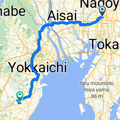
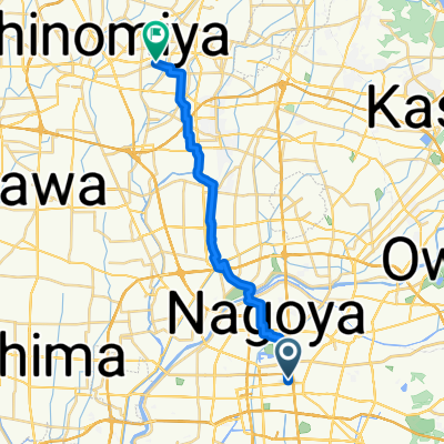
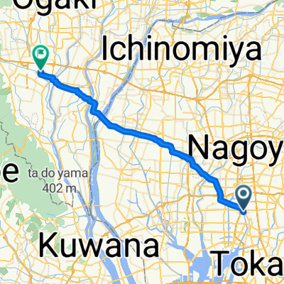
【愛知県】庄内川~定光寺~瀬戸の峠越えサイクリング
A cycling route starting in Nagoya, Aichi, Japan.
Overview
About this route
- -:--
- Duration
- 87.4 km
- Distance
- 1,273 m
- Ascent
- 1,276 m
- Descent
- ---
- Avg. speed
- ---
- Max. altitude

Route quality
Waytypes & surfaces along the route
Waytypes
Quiet road
32.3 km
(37 %)
Cycleway
14.9 km
(17 %)
Surfaces
Paved
37.6 km
(43 %)
Paved (undefined)
28 km
(32 %)
Asphalt
9.6 km
(11 %)
Undefined
49.8 km
(57 %)
Continue with Bikemap
Use, edit, or download this cycling route
You would like to ride 【愛知県】庄内川~定光寺~瀬戸の峠越えサイクリング or customize it for your own trip? Here is what you can do with this Bikemap route:
Free features
- Save this route as favorite or in collections
- Copy & plan your own version of this route
- Split it into stages to create a multi-day tour
- Sync your route with Garmin or Wahoo
Premium features
Free trial for 3 days, or one-time payment. More about Bikemap Premium.
- Navigate this route on iOS & Android
- Export a GPX / KML file of this route
- Create your custom printout (try it for free)
- Download this route for offline navigation
Discover more Premium features.
Get Bikemap PremiumFrom our community
Other popular routes starting in Nagoya
 Torisu 2-Chōme, Nagoya to Koseicho, Okazaki
- Distance
- 31.6 km
- Ascent
- 184 m
- Descent
- 175 m
- Location
- Nagoya, Aichi, Japan
 杁ヶ池公園
杁ヶ池公園- Distance
- 16.8 km
- Ascent
- 157 m
- Descent
- 95 m
- Location
- Nagoya, Aichi, Japan
 県道215号, 名古屋市千種区 to 金平町寺中28, 蒲郡市
- Distance
- 58.5 km
- Ascent
- 482 m
- Descent
- 411 m
- Location
- Nagoya, Aichi, Japan
 Nagoya - Nagahama
- Distance
- 68.8 km
- Ascent
- 336 m
- Descent
- 334 m
- Location
- Nagoya, Aichi, Japan
 実家⇆職場
実家⇆職場- Distance
- 21.5 km
- Ascent
- 61 m
- Descent
- 73 m
- Location
- Nagoya, Aichi, Japan
 Nagoya Gifu
- Distance
- 44.9 km
- Ascent
- 357 m
- Descent
- 350 m
- Location
- Nagoya, Aichi, Japan
 Nagoya - Ōgaki
- Distance
- 38.8 km
- Ascent
- 4 m
- Descent
- 0 m
- Location
- Nagoya, Aichi, Japan
 1-chōme to 5-chōme
- Distance
- 46 km
- Ascent
- 316 m
- Descent
- 400 m
- Location
- Nagoya, Aichi, Japan
Open it in the app