

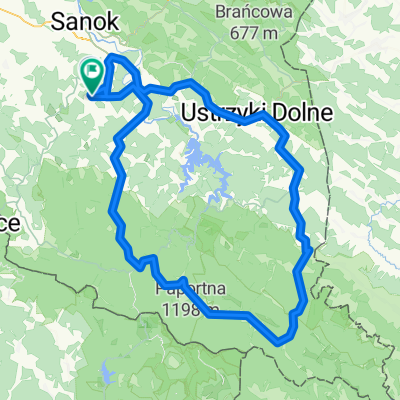
Bieszczady Sakwy 2020 day1
A cycling route starting in Czaszyn, Subcarpathian Voivodeship, Poland.
Overview
About this route
Tarnawa Dolna, Cryszczata, Łubków
- -:--
- Duration
- 43.2 km
- Distance
- 818 m
- Ascent
- 565 m
- Descent
- ---
- Avg. speed
- ---
- Max. altitude

Route quality
Waytypes & surfaces along the route
Waytypes
Road
15.1 km
(35 %)
Quiet road
13.8 km
(32 %)
Surfaces
Paved
31.3 km
(72 %)
Unpaved
10.8 km
(25 %)
Asphalt
27.9 km
(65 %)
Ground
8.8 km
(20 %)
Continue with Bikemap
Use, edit, or download this cycling route
You would like to ride Bieszczady Sakwy 2020 day1 or customize it for your own trip? Here is what you can do with this Bikemap route:
Free features
- Save this route as favorite or in collections
- Copy & plan your own version of this route
- Sync your route with Garmin or Wahoo
Premium features
Free trial for 3 days, or one-time payment. More about Bikemap Premium.
- Navigate this route on iOS & Android
- Export a GPX / KML file of this route
- Create your custom printout (try it for free)
- Download this route for offline navigation
Discover more Premium features.
Get Bikemap PremiumFrom our community
Other popular routes starting in Czaszyn
 czaszyn
- Distance
- 97.2 km
- Ascent
- 1,449 m
- Descent
- 1,431 m
- Location
- Czaszyn, Subcarpathian Voivodeship, Poland
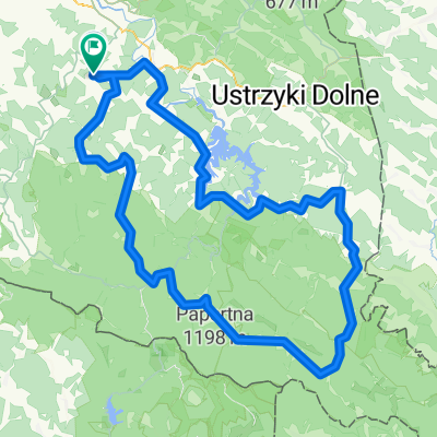
 Wielka Obwodnica Bieszczadzka
- Distance
- 178.1 km
- Ascent
- 2,730 m
- Descent
- 2,736 m
- Location
- Czaszyn, Subcarpathian Voivodeship, Poland
 Trasa do Księdza Romana Woźniaka 8, Czaszyn
- Distance
- 45.1 km
- Ascent
- 1,496 m
- Descent
- 1,543 m
- Location
- Czaszyn, Subcarpathian Voivodeship, Poland
 Bieszczady Sakwy 2020 day1
- Distance
- 43.2 km
- Ascent
- 818 m
- Descent
- 565 m
- Location
- Czaszyn, Subcarpathian Voivodeship, Poland
 Tarnawa Grn - Jeziorko Bobrowe - Wierchy
- Distance
- 80.9 km
- Ascent
- 1,226 m
- Descent
- 1,225 m
- Location
- Czaszyn, Subcarpathian Voivodeship, Poland
 Bieszczady
- Distance
- 171.9 km
- Ascent
- 3,337 m
- Descent
- 3,353 m
- Location
- Czaszyn, Subcarpathian Voivodeship, Poland
 Bieszczady 2015
- Distance
- 155.7 km
- Ascent
- 1,501 m
- Descent
- 1,503 m
- Location
- Czaszyn, Subcarpathian Voivodeship, Poland
 Bieszczady Jesień 2
- Distance
- 71.7 km
- Ascent
- 637 m
- Descent
- 761 m
- Location
- Czaszyn, Subcarpathian Voivodeship, Poland
Open it in the app