

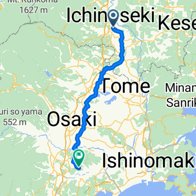
【岩手県】日本刀源流の地と世界遺産を満喫!レンタサイクルで巡る一ノ関・平泉
A cycling route starting in Ichinoseki, Iwate, Japan.
Overview
About this route
- -:--
- Duration
- 20.9 km
- Distance
- 186 m
- Ascent
- 189 m
- Descent
- ---
- Avg. speed
- ---
- Max. altitude

Continue with Bikemap
Use, edit, or download this cycling route
You would like to ride 【岩手県】日本刀源流の地と世界遺産を満喫!レンタサイクルで巡る一ノ関・平泉 or customize it for your own trip? Here is what you can do with this Bikemap route:
Free features
- Save this route as favorite or in collections
- Copy & plan your own version of this route
- Sync your route with Garmin or Wahoo
Premium features
Free trial for 3 days, or one-time payment. More about Bikemap Premium.
- Navigate this route on iOS & Android
- Export a GPX / KML file of this route
- Create your custom printout (try it for free)
- Download this route for offline navigation
Discover more Premium features.
Get Bikemap PremiumFrom our community
Other popular routes starting in Ichinoseki
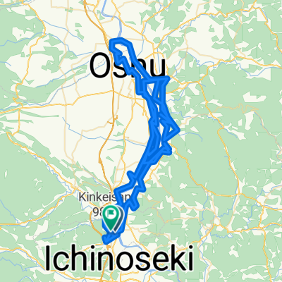
 Genbitei to Chusonji, Hiraizumi
- Distance
- 13.9 km
- Ascent
- 229 m
- Descent
- 275 m
- Location
- Ichinoseki, Iwate, Japan
 Day - 7 Japan Touring (13/10/2019)
- Distance
- 84.3 km
- Ascent
- 0 m
- Descent
- 0 m
- Location
- Ichinoseki, Iwate, Japan
 kiinagashima1
- Distance
- 82.6 km
- Ascent
- 273 m
- Descent
- 298 m
- Location
- Ichinoseki, Iwate, Japan
 Ichinoseki - Kogota
- Distance
- 78.1 km
- Ascent
- 712 m
- Descent
- 708 m
- Location
- Ichinoseki, Iwate, Japan
 testtest
- Distance
- 145.5 km
- Ascent
- 1,052 m
- Descent
- 1,050 m
- Location
- Ichinoseki, Iwate, Japan
 Sōgo, Ichinoseki to Ōsawa, Hiraizumi
- Distance
- 12.7 km
- Ascent
- 1,068 m
- Descent
- 1,189 m
- Location
- Ichinoseki, Iwate, Japan
 平治屋敷, 栗原市 to 3丁目 4, 盛岡市
- Distance
- 104.8 km
- Ascent
- 612 m
- Descent
- 511 m
- Location
- Ichinoseki, Iwate, Japan
 宮城1000K_PC2 - PC3
- Distance
- 76.2 km
- Ascent
- 282 m
- Descent
- 235 m
- Location
- Ichinoseki, Iwate, Japan
Open it in the app