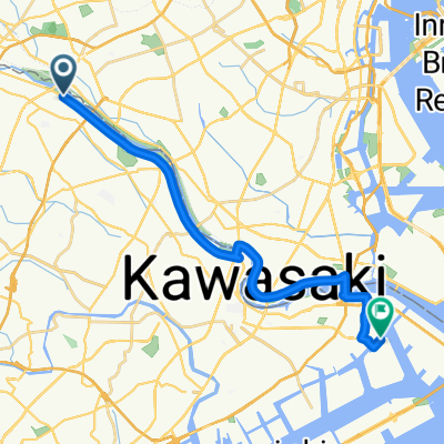
【東京都】もうすぐ紅葉ライドの季節!多摩川サイクリングロードで奥多摩へ~♪
A cycling route starting in Chōfu, Tokyo, Japan.
Overview
About this route
- -:--
- Duration
- 113.2 km
- Distance
- 4,315 m
- Ascent
- 4,249 m
- Descent
- ---
- Avg. speed
- ---
- Max. altitude
Continue with Bikemap
Use, edit, or download this cycling route
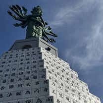
You would like to ride 【東京都】もうすぐ紅葉ライドの季節!多摩川サイクリングロードで奥多摩へ~♪ or customize it for your own trip? Here is what you can do with this Bikemap route:
Free features
- Save this route as favorite or in collections
- Copy & plan your own version of this route
- Split it into stages to create a multi-day tour
- Sync your route with Garmin or Wahoo
Premium features
Free trial for 3 days, or one-time payment. More about Bikemap Premium.
- Navigate this route on iOS & Android
- Export a GPX / KML file of this route
- Create your custom printout (try it for free)
- Download this route for offline navigation
Discover more Premium features.
Get Bikemap PremiumFrom our community
Other popular routes starting in Chōfu
Seta 5-Chōme, Setagaya to Nakamachi 2-Chōme, Setagaya- Distance
- 3.4 km
- Ascent
- 3 m
- Descent
- 10 m
- Location
- Chōfu, Tokyo, Japan
3-chōme 5, Kawasaki to Kawasaki- Distance
- 44.2 km
- Ascent
- 70 m
- Descent
- 40 m
- Location
- Chōfu, Tokyo, Japan
Tama River and Takao San- Distance
- 38.3 km
- Ascent
- 189 m
- Descent
- 19 m
- Location
- Chōfu, Tokyo, Japan
fhjfg- Distance
- 8.8 km
- Ascent
- 310 m
- Descent
- 304 m
- Location
- Chōfu, Tokyo, Japan
Somechi, Chofu to 6-29, Nakamachi 2-Chōme, Setagaya- Distance
- 10 km
- Ascent
- 42 m
- Descent
- 36 m
- Location
- Chōfu, Tokyo, Japan
miyagase- Distance
- 93.9 km
- Ascent
- 760 m
- Descent
- 760 m
- Location
- Chōfu, Tokyo, Japan
20101016 関戸橋フリマ〜高尾山- Distance
- 87.7 km
- Ascent
- 268 m
- Descent
- 268 m
- Location
- Chōfu, Tokyo, Japan
二子玉川night ride- Distance
- 10.5 km
- Ascent
- 85 m
- Descent
- 87 m
- Location
- Chōfu, Tokyo, Japan
Open it in the app


