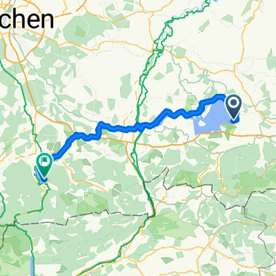
56km_Chiemsee Uferweg
- 56.2 km
- 180 m
- 179 m
- Chieming, Bavaria, Germany
A cycling route starting in Chieming, Bavaria, Germany.
Overview
Route: Chieming - Riederting - Rettenbach - Egerdach - St. Leonhard - Waging am See - Waging am See - Kammer - Nußdorf - Sondermoning - Egerer - Chieming Length: approx. 55 km in total on little-trafficked secondary roads or bike paths through hilly pre-Alpine terrain
created this 15 years ago
Continue with Bikemap
You would like to ride 56km_Chiemsee Uferweg or customize it for your own trip? Here is what you can do with this Bikemap route:
Free trial for 3 days, or one-time payment. More about Bikemap Premium.
Discover more Premium features.
Get Bikemap PremiumFrom our community
Open it in the app