ぐるっと走ろう!じてんしゃ王国 埼玉 サイクリングレポ Vol.1(鴻巣市、吉見町)<PR>
A cycling route starting in Okegawa, Saitama, Japan.
Overview
About this route
- -:--
- Duration
- 27.5 km
- Distance
- 127 m
- Ascent
- 127 m
- Descent
- ---
- Avg. speed
- ---
- Avg. speed
Route quality
Waytypes & surfaces along the route
Waytypes
Quiet road
13.6 km
(50 %)
Access road
6.4 km
(23 %)
Surfaces
Paved
1.8 km
(6 %)
Paved (undefined)
1.8 km
(6 %)
Undefined
25.7 km
(94 %)
Continue with Bikemap
Use, edit, or download this cycling route
You would like to ride ぐるっと走ろう!じてんしゃ王国 埼玉 サイクリングレポ Vol.1(鴻巣市、吉見町)<PR> or customize it for your own trip? Here is what you can do with this Bikemap route:
Free features
- Save this route as favorite or in collections
- Copy & plan your own version of this route
- Sync your route with Garmin or Wahoo
Premium features
Free trial for 3 days, or one-time payment. More about Bikemap Premium.
- Navigate this route on iOS & Android
- Export a GPX / KML file of this route
- Create your custom printout (try it for free)
- Download this route for offline navigation
Discover more Premium features.
Get Bikemap PremiumFrom our community
Other popular routes starting in Okegawa
- 25-5, Idogi 3-Chōme, Ageo to 13-7, Idogi 3-Chōme, Ageo
- Distance
- 22.5 km
- Ascent
- 49 m
- Descent
- 48 m
- Location
- Okegawa, Saitama, Japan
- 2丁目 9, 上尾市 まで4丁目, さいたま市
- Distance
- 12.5 km
- Ascent
- 7 m
- Descent
- 50 m
- Location
- Okegawa, Saitama, Japan
- Takao 9-Chōme, Kitamoto to Takao 9-Chōme, Kitamoto
- Distance
- 47.9 km
- Ascent
- 248 m
- Descent
- 236 m
- Location
- Okegawa, Saitama, Japan
- 29 都市と自然の回遊軸ルート
- Distance
- 10.5 km
- Ascent
- 38 m
- Descent
- 42 m
- Location
- Okegawa, Saitama, Japan
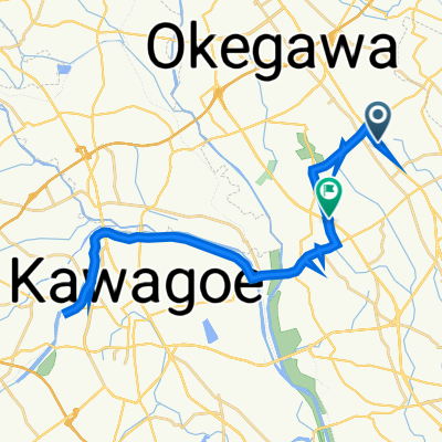
- Arakawa Exploring from Maruyama Park
- Distance
- 35.7 km
- Ascent
- 56 m
- Descent
- 56 m
- Location
- Okegawa, Saitama, Japan
- Demarushimogo, Kawajima, Hiki-Gun to Demarushimogo, Kawajima, Hiki-Gun
- Distance
- 28 km
- Ascent
- 185 m
- Descent
- 210 m
- Location
- Okegawa, Saitama, Japan
- 32 北本・桜と緑豊かな公園のルート
- Distance
- 10.6 km
- Ascent
- 61 m
- Descent
- 66 m
- Location
- Okegawa, Saitama, Japan
- 1丁目 3, 桶川市 まで2丁目 3, 桶川市
- Distance
- 21.2 km
- Ascent
- 106 m
- Descent
- 106 m
- Location
- Okegawa, Saitama, Japan
Open it in the app