

Berlin-Regbg-A
A cycling route starting in Kaulsdorf, State of Berlin, Germany.
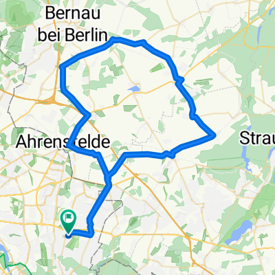
Overview
About this route
- -:--
- Duration
- 431.1 km
- Distance
- 970 m
- Ascent
- 625 m
- Descent
- ---
- Avg. speed
- ---
- Max. altitude
Route quality
Waytypes & surfaces along the route
Waytypes
Road
155.2 km
(36 %)
Quiet road
73.3 km
(17 %)
Surfaces
Paved
327.6 km
(76 %)
Unpaved
21.6 km
(5 %)
Asphalt
319 km
(74 %)
Gravel
12.9 km
(3 %)
Route highlights
Points of interest along the route
Point of interest after 32.1 km
Dahlem
Continue with Bikemap
Use, edit, or download this cycling route
You would like to ride Berlin-Regbg-A or customize it for your own trip? Here is what you can do with this Bikemap route:
Free features
- Save this route as favorite or in collections
- Copy & plan your own version of this route
- Split it into stages to create a multi-day tour
- Sync your route with Garmin or Wahoo
Premium features
Free trial for 3 days, or one-time payment. More about Bikemap Premium.
- Navigate this route on iOS & Android
- Export a GPX / KML file of this route
- Create your custom printout (try it for free)
- Download this route for offline navigation
Discover more Premium features.
Get Bikemap PremiumFrom our community
Other popular routes starting in Kaulsdorf
 Rund um Blumberg
- Distance
- 45.5 km
- Ascent
- 72 m
- Descent
- 75 m
- Location
- Kaulsdorf, State of Berlin, Germany
 Weg_Oma_Berlin
- Distance
- 0.8 km
- Ascent
- 0 m
- Descent
- 6 m
- Location
- Kaulsdorf, State of Berlin, Germany
 De Teterower Ring 35, Berlin a Französische Straße 2, Berlin
- Distance
- 17 km
- Ascent
- 224 m
- Descent
- 235 m
- Location
- Kaulsdorf, State of Berlin, Germany
 Biesdorfer Friedhofsweg, Berlin nach Birnbaumer Straße 36, Berlin
- Distance
- 8.4 km
- Ascent
- 0 m
- Descent
- 4 m
- Location
- Kaulsdorf, State of Berlin, Germany
 Bernauer Acht
- Distance
- 96.5 km
- Ascent
- 241 m
- Descent
- 235 m
- Location
- Kaulsdorf, State of Berlin, Germany
 2014.06.20 Seniorenradeln
- Distance
- 32.2 km
- Ascent
- 68 m
- Descent
- 58 m
- Location
- Kaulsdorf, State of Berlin, Germany
 Strecke Laurin 67 Km
- Distance
- 66.1 km
- Ascent
- 99 m
- Descent
- 96 m
- Location
- Kaulsdorf, State of Berlin, Germany
 De Teterower Ring 35, Berlin a Französische Straße 211, Berlin
- Distance
- 16.2 km
- Ascent
- 120 m
- Descent
- 137 m
- Location
- Kaulsdorf, State of Berlin, Germany
Open it in the app