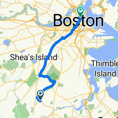
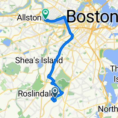
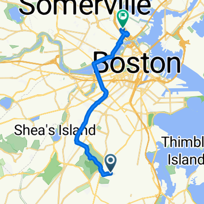
where is the fruit?
A cycling route starting in Jamaica Plain, Massachusetts, United States of America.
Overview
About this route
find the fig tree, tomatoe plantĀ and papaya tree
- -:--
- Duration
- 6.3 km
- Distance
- 64 m
- Ascent
- 74 m
- Descent
- ---
- Avg. speed
- ---
- Avg. speed
Route photos
Route quality
Waytypes & surfaces along the route
Waytypes
Road
3 km
(47 %)
Quiet road
2.8 km
(44 %)
Surfaces
Paved
5.6 km
(89 %)
Asphalt
5.6 km
(89 %)
Concrete
0 km
(<1 %)
Undefined
0.7 km
(11 %)
Route highlights
Points of interest along the route
Point of interest after 1.8 km
fig tree
Point of interest after 2.6 km
tomato plant
Point of interest after 5.2 km
papaya tree
Continue with Bikemap
Use, edit, or download this cycling route
You would like to ride where is the fruit? or customize it for your own trip? Here is what you can do with this Bikemap route:
Free features
- Save this route as favorite or in collections
- Copy & plan your own version of this route
- Sync your route with Garmin or Wahoo
Premium features
Free trial for 3 days, or one-time payment. More about Bikemap Premium.
- Navigate this route on iOS & Android
- Export a GPX / KML file of this route
- Create your custom printout (try it for free)
- Download this route for offline navigation
Discover more Premium features.
Get Bikemap PremiumFrom our community
Other popular routes starting in Jamaica Plain
- Beethoven Street 21, Boston to Beethoven Street 24, Boston
- Distance
- 60.7 km
- Ascent
- 226 m
- Descent
- 238 m
- Location
- Jamaica Plain, Massachusetts, United States of America
- neponset loop
- Distance
- 35.9 km
- Ascent
- 133 m
- Descent
- 133 m
- Location
- Jamaica Plain, Massachusetts, United States of America
- loopA
- Distance
- 14.2 km
- Ascent
- 613 m
- Descent
- 613 m
- Location
- Jamaica Plain, Massachusetts, United States of America
- where is the fruit?
- Distance
- 6.3 km
- Ascent
- 64 m
- Descent
- 74 m
- Location
- Jamaica Plain, Massachusetts, United States of America
- 14 Symmes, Roslindale
- Distance
- 4.5 km
- Ascent
- 81 m
- Descent
- 46 m
- Location
- Jamaica Plain, Massachusetts, United States of America
- Glenvale Terr, Boston to Granite Ave, Boston
- Distance
- 11.4 km
- Ascent
- 79 m
- Descent
- 100 m
- Location
- Jamaica Plain, Massachusetts, United States of America
- Rose Kennedy Greenway
- Distance
- 9.3 km
- Ascent
- 83 m
- Descent
- 89 m
- Location
- Jamaica Plain, Massachusetts, United States of America
- Roslindale to Neponset Trail to Roslindale
- Distance
- 20.1 km
- Ascent
- 111 m
- Descent
- 113 m
- Location
- Jamaica Plain, Massachusetts, United States of America