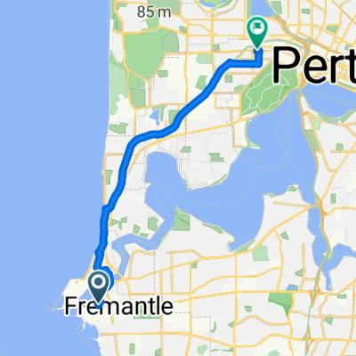
Fremantle to Daglish
A cycling route starting in Fremantle, Western Australia, Australia.
Overview
About this route
- 47 min
- Duration
- 15.6 km
- Distance
- 139 m
- Ascent
- 112 m
- Descent
- 20.1 km/h
- Avg. speed
- ---
- Avg. speed
Route quality
Waytypes & surfaces along the route
Waytypes
Path
7.3 km
(46 %)
Pedestrian area
2.1 km
(13 %)
Surfaces
Paved
14.5 km
(93 %)
Asphalt
11.6 km
(74 %)
Paved (undefined)
1.8 km
(12 %)
Continue with Bikemap
Use, edit, or download this cycling route
You would like to ride Fremantle to Daglish or customize it for your own trip? Here is what you can do with this Bikemap route:
Free features
- Save this route as favorite or in collections
- Copy & plan your own version of this route
- Sync your route with Garmin or Wahoo
Premium features
Free trial for 3 days, or one-time payment. More about Bikemap Premium.
- Navigate this route on iOS & Android
- Export a GPX / KML file of this route
- Create your custom printout (try it for free)
- Download this route for offline navigation
Discover more Premium features.
Get Bikemap PremiumFrom our community
Other popular routes starting in Fremantle
- 61 Forrest St, Fremantle to 836 Wellington St, West Perth
- Distance
- 18.8 km
- Ascent
- 158 m
- Descent
- 162 m
- Location
- Fremantle, Western Australia, Australia
- Adelaide Street, Fremantle to 222 Hay Street, Subiaco
- Distance
- 16.9 km
- Ascent
- 10 m
- Descent
- 0 m
- Location
- Fremantle, Western Australia, Australia
- Coast route Freo to Joondalup
- Distance
- 43.9 km
- Ascent
- 277 m
- Descent
- 239 m
- Location
- Fremantle, Western Australia, Australia
- wood to kent
- Distance
- 15.9 km
- Ascent
- 73 m
- Descent
- 85 m
- Location
- Fremantle, Western Australia, Australia
- Peter Hughes Drive, Fremantle to 46 Grand Ocean Entrance, Burns Beach
- Distance
- 42.4 km
- Ascent
- 394 m
- Descent
- 372 m
- Location
- Fremantle, Western Australia, Australia
- Wood St Fremantle to Melville Beach Rd
- Distance
- 8.8 km
- Ascent
- 59 m
- Descent
- 78 m
- Location
- Fremantle, Western Australia, Australia
- State Route 12, Fremantle to Whitfords Avenue 115, Hillarys
- Distance
- 28.9 km
- Ascent
- 154 m
- Descent
- 173 m
- Location
- Fremantle, Western Australia, Australia
- Fremantle to Canning Bridge
- Distance
- 15.7 km
- Ascent
- 80 m
- Descent
- 84 m
- Location
- Fremantle, Western Australia, Australia
Open it in the app