Radtour Binsfeld Zellingen Karlstadt Eußenheim
- 40.3 km
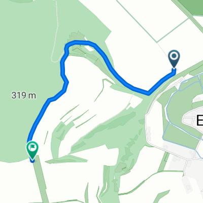
- 388 m
- 388 m
- Eußenheim, Bavaria, Germany
Wanderwege Eußenheim
A cycling route starting in Eußenheim, Bavaria, Germany.
Overview
Dies ist ein Wanderweg, der in der Wanderkarte der Gemeinde Eußenheim von 2016 (siehe Titelbild) und auch in der Fritsch Wanderkarte 88 (Landkreis Main-Spessasrt) enthalten ist. Die Wegführung wurde in 2016 teilweise geändert, weil der Weg jetzt als Rundweg ab dem Dorfplatz von Eußenheim ausgeschildert ist.
Die Strecke ist leider für Mountainbiker nicht geeignet, weil sie durch das Naturschutzgebiet Am Kalbenstein führt. Eine Abzweigung die um das Naturschutzgebiet herum führt ist für Radfahrer ausgeschildert.
created this 5 years ago
Part of
6 stages
Route quality
Track
6.9 km
(65 %)
Quiet road
1.5 km
(14 %)
Paved
3.2 km
(30 %)
Unpaved
4.7 km
(44 %)
Asphalt
2 km
(19 %)
Ground
1.9 km
(18 %)
Continue with Bikemap
You would like to ride Wanderweg Nr. 02 Eußenheim Zum Edelweis Nach der Wanderkarte Eußenheim 2016 or customize it for your own trip? Here is what you can do with this Bikemap route:
Free trial for 3 days, or one-time payment. More about Bikemap Premium.
Discover more Premium features.
Get Bikemap PremiumFrom our community
Open it in the app