

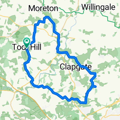
ACL Rehab Route
A cycling route starting in Chipping Ongar, England, United Kingdom.
Overview
About this route
Ongar > Moreton > Fyfield > Ongar
- -:--
- Duration
- 11.3 km
- Distance
- 65 m
- Ascent
- 65 m
- Descent
- ---
- Avg. speed
- ---
- Max. altitude

Route quality
Waytypes & surfaces along the route
Waytypes
Road
7.3 km
(65 %)
Quiet road
0.9 km
(8 %)
Undefined
3.1 km
(27 %)
Surfaces
Paved
3.1 km
(27 %)
Asphalt
3.1 km
(27 %)
Undefined
8.3 km
(73 %)
Continue with Bikemap
Use, edit, or download this cycling route
You would like to ride ACL Rehab Route or customize it for your own trip? Here is what you can do with this Bikemap route:
Free features
- Save this route as favorite or in collections
- Copy & plan your own version of this route
- Sync your route with Garmin or Wahoo
Premium features
Free trial for 3 days, or one-time payment. More about Bikemap Premium.
- Navigate this route on iOS & Android
- Export a GPX / KML file of this route
- Create your custom printout (try it for free)
- Download this route for offline navigation
Discover more Premium features.
Get Bikemap PremiumFrom our community
Other popular routes starting in Chipping Ongar
 Relaxed route in Ongar
- Distance
- 33.5 km
- Ascent
- 276 m
- Descent
- 279 m
- Location
- Chipping Ongar, England, United Kingdom
 Ashlyns Lane, Magdalen Laver, Ongar to Ashlyns Lane, Bobbingworth, Ongar
- Distance
- 34.8 km
- Ascent
- 269 m
- Descent
- 255 m
- Location
- Chipping Ongar, England, United Kingdom
 Farm Cottage, Ashlyns Lane, Ongar to Ashlyns Lane, Bobbingworth, Ongar
- Distance
- 19.6 km
- Ascent
- 143 m
- Descent
- 140 m
- Location
- Chipping Ongar, England, United Kingdom
 Parkland Way 3 to Green Walk 47
- Distance
- 29.3 km
- Ascent
- 161 m
- Descent
- 161 m
- Location
- Chipping Ongar, England, United Kingdom
 Billericay, rodings
- Distance
- 86.5 km
- Ascent
- 575 m
- Descent
- 560 m
- Location
- Chipping Ongar, England, United Kingdom
 ACL Rehab Route
- Distance
- 11.3 km
- Ascent
- 65 m
- Descent
- 65 m
- Location
- Chipping Ongar, England, United Kingdom
 School Road, Ongar to 38 Mafeking Avenue, Ilford
- Distance
- 27.9 km
- Ascent
- 233 m
- Descent
- 307 m
- Location
- Chipping Ongar, England, United Kingdom
 That Thaxted Bike Route
- Distance
- 90 km
- Ascent
- 531 m
- Descent
- 531 m
- Location
- Chipping Ongar, England, United Kingdom
Open it in the app