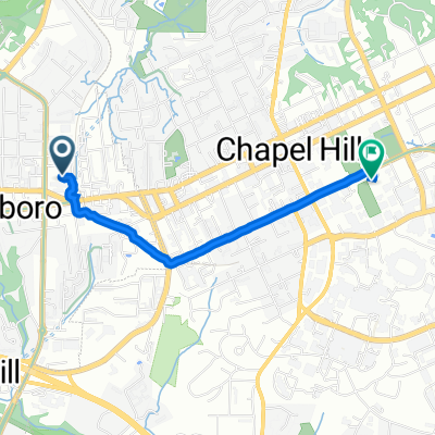
Mapleview + Loop
A cycling route starting in Carrboro, North Carolina, United States of America.
Overview
About this route
- -:--
- Duration
- 34 km
- Distance
- 187 m
- Ascent
- 187 m
- Descent
- ---
- Avg. speed
- ---
- Avg. speed
Route quality
Waytypes & surfaces along the route
Waytypes
Road
24.6 km
(72 %)
Busy road
6.5 km
(19 %)
Surfaces
Paved
33.3 km
(98 %)
Unpaved
0.7 km
(2 %)
Asphalt
32.4 km
(95 %)
Paved (undefined)
0.8 km
(2 %)
Continue with Bikemap
Use, edit, or download this cycling route
You would like to ride Mapleview + Loop or customize it for your own trip? Here is what you can do with this Bikemap route:
Free features
- Save this route as favorite or in collections
- Copy & plan your own version of this route
- Sync your route with Garmin or Wahoo
Premium features
Free trial for 3 days, or one-time payment. More about Bikemap Premium.
- Navigate this route on iOS & Android
- Export a GPX / KML file of this route
- Create your custom printout (try it for free)
- Download this route for offline navigation
Discover more Premium features.
Get Bikemap PremiumFrom our community
Other popular routes starting in Carrboro
- Saxapahaw 2
- Distance
- 36.1 km
- Ascent
- 297 m
- Descent
- 295 m
- Location
- Carrboro, North Carolina, United States of America
- Tarwheels Trip to SaxaPhahaw
- Distance
- 67.3 km
- Ascent
- 282 m
- Descent
- 282 m
- Location
- Carrboro, North Carolina, United States of America
- UG36.5 Mebane
- Distance
- 59.2 km
- Ascent
- 246 m
- Descent
- 243 m
- Location
- Carrboro, North Carolina, United States of America
- Mapleview + Loop
- Distance
- 34 km
- Ascent
- 187 m
- Descent
- 187 m
- Location
- Carrboro, North Carolina, United States of America
- Chapel Hill loop
- Distance
- 24.3 km
- Ascent
- 211 m
- Descent
- 212 m
- Location
- Carrboro, North Carolina, United States of America
- 50mile CH
- Distance
- 79.8 km
- Ascent
- 251 m
- Descent
- 256 m
- Location
- Carrboro, North Carolina, United States of America
- Maple View Intermediate
- Distance
- 35.6 km
- Ascent
- 213 m
- Descent
- 212 m
- Location
- Carrboro, North Carolina, United States of America
- Southern Village to Whole Foods / Elliot Road area
- Distance
- 9.4 km
- Ascent
- 89 m
- Descent
- 105 m
- Location
- Carrboro, North Carolina, United States of America
Open it in the app