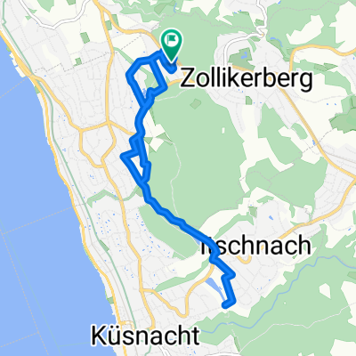
19980619 Zollikerberg-Meilen-Rüti-Hinwil-Wetzikon-Oetwil-Zollikerberg
A cycling route starting in Zollikerberg, Canton of Zurich, Switzerland.
Overview
About this route
- -:--
- Duration
- 64.4 km
- Distance
- 525 m
- Ascent
- 524 m
- Descent
- ---
- Avg. speed
- ---
- Avg. speed
Route quality
Waytypes & surfaces along the route
Waytypes
Busy road
23.9 km
(37 %)
Path
14.8 km
(23 %)
Surfaces
Paved
59.4 km
(92 %)
Unpaved
0.1 km
(<1 %)
Asphalt
58.4 km
(91 %)
Concrete
0.5 km
(<1 %)
Continue with Bikemap
Use, edit, or download this cycling route
You would like to ride 19980619 Zollikerberg-Meilen-Rüti-Hinwil-Wetzikon-Oetwil-Zollikerberg or customize it for your own trip? Here is what you can do with this Bikemap route:
Free features
- Save this route as favorite or in collections
- Copy & plan your own version of this route
- Sync your route with Garmin or Wahoo
Premium features
Free trial for 3 days, or one-time payment. More about Bikemap Premium.
- Navigate this route on iOS & Android
- Export a GPX / KML file of this route
- Create your custom printout (try it for free)
- Download this route for offline navigation
Discover more Premium features.
Get Bikemap PremiumFrom our community
Other popular routes starting in Zollikerberg
- Roswiesstrasse 3, Zollikerberg nach Hardturmstrasse 131, Zürich
- Distance
- 11 km
- Ascent
- 26 m
- Descent
- 220 m
- Location
- Zollikerberg, Canton of Zurich, Switzerland
- 19980619 Zollikerberg-Meilen-Rüti-Hinwil-Wetzikon-Oetwil-Zollikerberg
- Distance
- 64.4 km
- Ascent
- 525 m
- Descent
- 524 m
- Location
- Zollikerberg, Canton of Zurich, Switzerland
- Feierabend-Route Hirslanden-Pfannenstil
- Distance
- 23.5 km
- Ascent
- 531 m
- Descent
- 600 m
- Location
- Zollikerberg, Canton of Zurich, Switzerland
- In der Deisten 8, Zollikerberg nach Hardturmstrasse 133, Zürich
- Distance
- 11.1 km
- Ascent
- 13 m
- Descent
- 217 m
- Location
- Zollikerberg, Canton of Zurich, Switzerland
- In der Deisten 8, Zollikerberg nach Hardturmstrasse 133, Zürich
- Distance
- 11.1 km
- Ascent
- 28 m
- Descent
- 218 m
- Location
- Zollikerberg, Canton of Zurich, Switzerland
- Wilhofstrasse 10, Zollikerberg nach Hardturmstrasse 133, Zürich
- Distance
- 11.3 km
- Ascent
- 696 m
- Descent
- 914 m
- Location
- Zollikerberg, Canton of Zurich, Switzerland
- Lützelsee Stäfa
- Distance
- 47.8 km
- Ascent
- 430 m
- Descent
- 429 m
- Location
- Zollikerberg, Canton of Zurich, Switzerland
- zollikerberg-greifensee-pfannenstiel-zollikerberg
- Distance
- 35.5 km
- Ascent
- 572 m
- Descent
- 572 m
- Location
- Zollikerberg, Canton of Zurich, Switzerland
Open it in the app