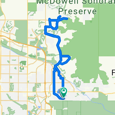
7175 E Camelback Rd, Scottsdale to 7769 E Joshua Tree Ln, Scottsdale
A cycling route starting in Scottsdale, Arizona, United States of America.
Overview
About this route
- 22 min
- Duration
- 6.4 km
- Distance
- 4 m
- Ascent
- 0 m
- Descent
- 17.7 km/h
- Avg. speed
- ---
- Avg. speed
Route quality
Waytypes & surfaces along the route
Waytypes
Road
2.8 km
(43 %)
Quiet road
1.4 km
(22 %)
Surfaces
Paved
6.1 km
(96 %)
Unpaved
0.3 km
(4 %)
Asphalt
5.1 km
(79 %)
Concrete
1.1 km
(17 %)
Continue with Bikemap
Use, edit, or download this cycling route
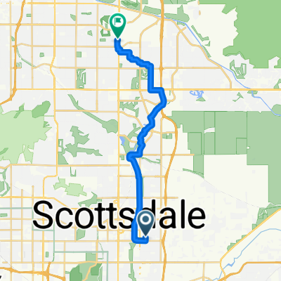
You would like to ride 7175 E Camelback Rd, Scottsdale to 7769 E Joshua Tree Ln, Scottsdale or customize it for your own trip? Here is what you can do with this Bikemap route:
Free features
- Save this route as favorite or in collections
- Copy & plan your own version of this route
- Sync your route with Garmin or Wahoo
Premium features
Free trial for 3 days, or one-time payment. More about Bikemap Premium.
- Navigate this route on iOS & Android
- Export a GPX / KML file of this route
- Create your custom printout (try it for free)
- Download this route for offline navigation
Discover more Premium features.
Get Bikemap PremiumFrom our community
Other popular routes starting in Scottsdale
- Biltmore Loop
- Distance
- 25.4 km
- Ascent
- 89 m
- Descent
- 89 m
- Location
- Scottsdale, Arizona, United States of America
- Scottsdale to Maricopa
- Distance
- 93.6 km
- Ascent
- 72 m
- Descent
- 109 m
- Location
- Scottsdale, Arizona, United States of America
- 10335 E Larkspur Dr, Scottsdale to 10335 E Larkspur Dr, Scottsdale
- Distance
- 19.5 km
- Ascent
- 54 m
- Descent
- 54 m
- Location
- Scottsdale, Arizona, United States of America
- DBL MTN RUN
- Distance
- 28.9 km
- Ascent
- 190 m
- Descent
- 188 m
- Location
- Scottsdale, Arizona, United States of America
- greenbelt/tempearts
- Distance
- 14.4 km
- Ascent
- 47 m
- Descent
- 76 m
- Location
- Scottsdale, Arizona, United States of America
- Scottsdale Loop
- Distance
- 29.7 km
- Ascent
- 98 m
- Descent
- 98 m
- Location
- Scottsdale, Arizona, United States of America
- scottsdale to tonto
- Distance
- 135.9 km
- Ascent
- 1,087 m
- Descent
- 773 m
- Location
- Scottsdale, Arizona, United States of America
- Drunken Warrior
- Distance
- 22.9 km
- Ascent
- 93 m
- Descent
- 96 m
- Location
- Scottsdale, Arizona, United States of America
Open it in the app