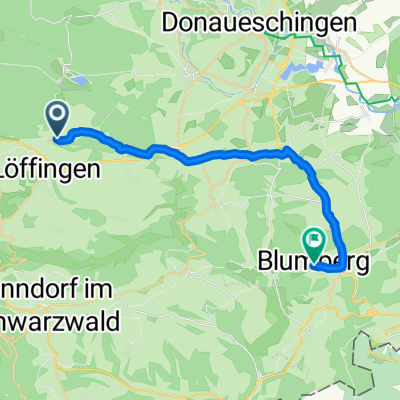
Von Löffingen bis Blumberg
- 23.2 km
- 338 m
- 422 m
- Löffingen, Baden-Wurttemberg, Germany
A cycling route starting in Löffingen, Baden-Wurttemberg, Germany.
Overview
4 Black Forest Mountains
Start/Finish: Bachheim
Mountains (elevation in m.a.s.l.) :
Thurner (ca. 1023)
Feldberg (pass height 1230)
Belchen (Belchenhaus 1356)
Stohren (1023)
The route tool currently does not allow for the return route from Thurner to be the same as the outbound route. A separate return route will be generated via the B31.
created this 17 years ago
Route quality
Road
36.1 km
24 %
Track
15 km
10 %
Paved
118.9 km
(79 %)
Unpaved
16.6 km
(11 %)
Asphalt
115.9 km
77 %
Gravel
7.5 km
5 %
Continue with Bikemap
You would like to ride 4 Schwarzwaldberge (180 km / 3600 hm) or customize it for your own trip? Here is what you can do with this Bikemap route:
Free trial for 3 days, or one-time payment. More about Bikemap Premium.
Discover more Premium features.
Get Bikemap PremiumFrom our community
Open it in the app