

Neukirchen zum Attersee ( Litzlberg)
A cycling route starting in Redleiten, Upper Austria, Austria.
Overview
About this route
as much as possible without using heavily trafficked main roads
- -:--
- Duration
- 18.5 km
- Distance
- 214 m
- Ascent
- 256 m
- Descent
- ---
- Avg. speed
- ---
- Max. altitude
Continue with Bikemap
Use, edit, or download this cycling route
You would like to ride Neukirchen zum Attersee ( Litzlberg) or customize it for your own trip? Here is what you can do with this Bikemap route:
Free features
- Save this route as favorite or in collections
- Copy & plan your own version of this route
- Sync your route with Garmin or Wahoo
Premium features
Free trial for 3 days, or one-time payment. More about Bikemap Premium.
- Navigate this route on iOS & Android
- Export a GPX / KML file of this route
- Create your custom printout (try it for free)
- Download this route for offline navigation
Discover more Premium features.
Get Bikemap PremiumFrom our community
Other popular routes starting in Redleiten
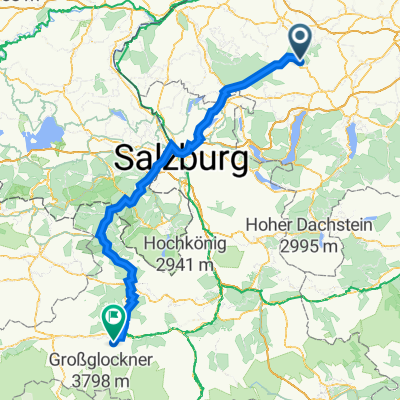 Hausruck Straße 6, Ampflwang im Hausruckwald nach Kitzsteinhornstraße 10, Kaprun
- Distance
- 199.8 km
- Ascent
- 1,254 m
- Descent
- 1,046 m
- Location
- Redleiten, Upper Austria, Austria
 Ampflwang Rundstrecke
- Distance
- 46.3 km
- Ascent
- 657 m
- Descent
- 660 m
- Location
- Redleiten, Upper Austria, Austria
 Moderate Route in Frankenburg am Hausruck
- Distance
- 4.6 km
- Ascent
- 110 m
- Descent
- 104 m
- Location
- Redleiten, Upper Austria, Austria
 Neukirchen - Vöcklabruck
- Distance
- 14.3 km
- Ascent
- 62 m
- Descent
- 163 m
- Location
- Redleiten, Upper Austria, Austria
 Göblberg - Pettenfirst - 30km
- Distance
- 29.8 km
- Ascent
- 595 m
- Descent
- 596 m
- Location
- Redleiten, Upper Austria, Austria
 Zell Hausruck Göblberg innerleiten
- Distance
- 24.8 km
- Ascent
- 517 m
- Descent
- 506 m
- Location
- Redleiten, Upper Austria, Austria
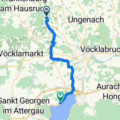 Neukirchen zum Attersee ( Litzlberg)
- Distance
- 18.5 km
- Ascent
- 214 m
- Descent
- 256 m
- Location
- Redleiten, Upper Austria, Austria
 Zell, Göblberg
- Distance
- 23 km
- Ascent
- 519 m
- Descent
- 515 m
- Location
- Redleiten, Upper Austria, Austria
Open it in the app