
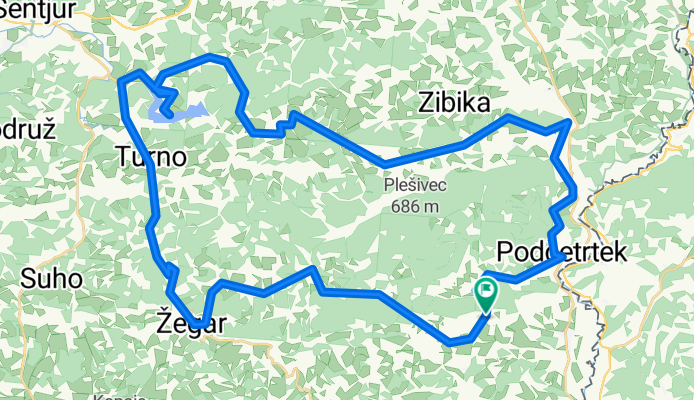
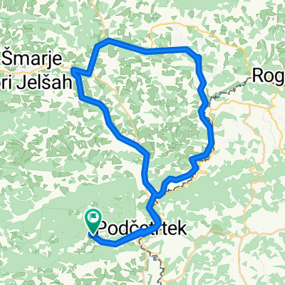
cmereška gorca - slivniško jezero - žeger - olimje
A cycling route starting in Podčetrtek, Občina Podčetrtek, Slovenia.
Overview
About this route
- -:--
- Duration
- 55.4 km
- Distance
- 915 m
- Ascent
- 915 m
- Descent
- ---
- Avg. speed
- ---
- Max. altitude

Route quality
Waytypes & surfaces along the route
Waytypes
Quiet road
39.4 km
(71 %)
Road
5.5 km
(10 %)
Surfaces
Paved
10 km
(18 %)
Unpaved
1.1 km
(2 %)
Asphalt
10 km
(18 %)
Gravel
1.1 km
(2 %)
Undefined
44.3 km
(80 %)
Continue with Bikemap
Use, edit, or download this cycling route
You would like to ride cmereška gorca - slivniško jezero - žeger - olimje or customize it for your own trip? Here is what you can do with this Bikemap route:
Free features
- Save this route as favorite or in collections
- Copy & plan your own version of this route
- Sync your route with Garmin or Wahoo
Premium features
Free trial for 3 days, or one-time payment. More about Bikemap Premium.
- Navigate this route on iOS & Android
- Export a GPX / KML file of this route
- Create your custom printout (try it for free)
- Download this route for offline navigation
Discover more Premium features.
Get Bikemap PremiumFrom our community
Other popular routes starting in Podčetrtek
 Podčetrtek Kumrovec Rogaška slatina
- Distance
- 70.6 km
- Ascent
- 396 m
- Descent
- 411 m
- Location
- Podčetrtek, Občina Podčetrtek, Slovenia
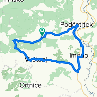 Podčetrtek, Vištanj
- Distance
- 16.1 km
- Ascent
- 194 m
- Descent
- 194 m
- Location
- Podčetrtek, Občina Podčetrtek, Slovenia
 Slovenie, 2 oktober 2013, Podcetrtek-Novo Mesto
- Distance
- 112 km
- Ascent
- 852 m
- Descent
- 876 m
- Location
- Podčetrtek, Občina Podčetrtek, Slovenia
 Po Sloveniji 2020_2
- Distance
- 129.6 km
- Ascent
- 860 m
- Descent
- 862 m
- Location
- Podčetrtek, Občina Podčetrtek, Slovenia
 cmereška gorca - slivniško jezero - žeger - olimje
- Distance
- 55.4 km
- Ascent
- 915 m
- Descent
- 915 m
- Location
- Podčetrtek, Občina Podčetrtek, Slovenia
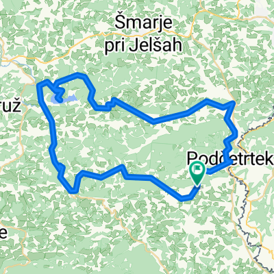
 Olimje blato tour
- Distance
- 63.2 km
- Ascent
- 400 m
- Descent
- 577 m
- Location
- Podčetrtek, Občina Podčetrtek, Slovenia
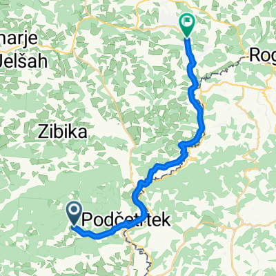 Rogaška 2
- Distance
- 16.7 km
- Ascent
- 114 m
- Descent
- 138 m
- Location
- Podčetrtek, Občina Podčetrtek, Slovenia
 Rogaška 1
- Distance
- 41.8 km
- Ascent
- 238 m
- Descent
- 239 m
- Location
- Podčetrtek, Občina Podčetrtek, Slovenia
Open it in the app