

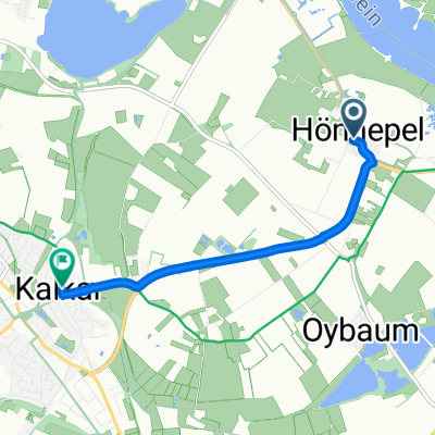
Kalkar 1
A cycling route starting in Kalkar, North Rhine-Westphalia, Germany.
Overview
About this route
- -:--
- Duration
- 9.8 km
- Distance
- 4 m
- Ascent
- 9 m
- Descent
- ---
- Avg. speed
- ---
- Max. altitude

Route quality
Waytypes & surfaces along the route
Waytypes
Quiet road
5.1 km
(52 %)
Path
4.7 km
(48 %)
Surfaces
Paved
8.5 km
(87 %)
Unpaved
0.1 km
(1 %)
Asphalt
8.5 km
(87 %)
Pebblestone
0.1 km
(1 %)
Undefined
1.2 km
(12 %)
Continue with Bikemap
Use, edit, or download this cycling route
You would like to ride Kalkar 1 or customize it for your own trip? Here is what you can do with this Bikemap route:
Free features
- Save this route as favorite or in collections
- Copy & plan your own version of this route
- Sync your route with Garmin or Wahoo
Premium features
Free trial for 3 days, or one-time payment. More about Bikemap Premium.
- Navigate this route on iOS & Android
- Export a GPX / KML file of this route
- Create your custom printout (try it for free)
- Download this route for offline navigation
Discover more Premium features.
Get Bikemap PremiumFrom our community
Other popular routes starting in Kalkar
 Fähre-Grieth-Wissel-Emmerich-Bienen-Grietherort-Fähre
- Distance
- 44.6 km
- Ascent
- 30 m
- Descent
- 32 m
- Location
- Kalkar, North Rhine-Westphalia, Germany
 Route zu Kalkar Marktplatz
- Distance
- 4.2 km
- Ascent
- 3 m
- Descent
- 0 m
- Location
- Kalkar, North Rhine-Westphalia, Germany
 Grieth-Xanten-Rees
- Distance
- 43 km
- Ascent
- 61 m
- Descent
- 54 m
- Location
- Kalkar, North Rhine-Westphalia, Germany
 Appeldorn-Ginderich-Xanten-Appeldorn
- Distance
- 54.1 km
- Ascent
- 69 m
- Descent
- 67 m
- Location
- Kalkar, North Rhine-Westphalia, Germany
 Kalkar-Moyland- Rees-Bislich-Xanten-Kalkar
- Distance
- 62.2 km
- Ascent
- 45 m
- Descent
- 53 m
- Location
- Kalkar, North Rhine-Westphalia, Germany
 Von Kalkar bis Rees
- Distance
- 7.4 km
- Ascent
- 6 m
- Descent
- 0 m
- Location
- Kalkar, North Rhine-Westphalia, Germany
 Kalkar-Emmerich-Elten-Zevenaar-Zeddam-s.Heerenberg-Emmerich-Kalkar
- Distance
- 78.2 km
- Ascent
- 196 m
- Descent
- 195 m
- Location
- Kalkar, North Rhine-Westphalia, Germany
 Moyland-Kalkar-Xanten-Rees-Moyland CLONED FROM ROUTE 157879
- Distance
- 62.3 km
- Ascent
- 40 m
- Descent
- 40 m
- Location
- Kalkar, North Rhine-Westphalia, Germany
Open it in the app