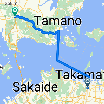
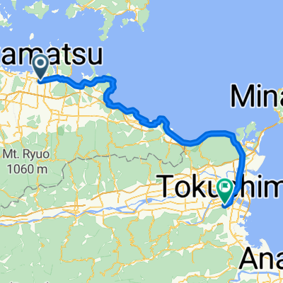
Shikoku trip day1
A cycling route starting in Takamatsu, Kagawa, Japan.
Overview
About this route
Name: 2019-07-23 10:30
Start time: 07/23/2019 09:31
Finish time: 07/24/2019 09:24
Distance: 57.6 km (23:53)
Moving time: 18:00
Average speed: 2.4 km/h
Avg. Speed Mov.: 3.2 km/h
Max. Speed: 139.6 km/h
Minimum altitude: -49 m
Maximum altitude: 229 m
Ascent speed: 186.3 m/h
Descent speed: -82.8 m/h
Elevation gain: 611 m
Elevation loss: -741 m
Ascent time: 03:16
Descent time: 08:56
- -:--
- Duration
- 51.2 km
- Distance
- 441 m
- Ascent
- 574 m
- Descent
- ---
- Avg. speed
- ---
- Max. altitude
Continue with Bikemap
Use, edit, or download this cycling route
You would like to ride Shikoku trip day1 or customize it for your own trip? Here is what you can do with this Bikemap route:
Free features
- Save this route as favorite or in collections
- Copy & plan your own version of this route
- Sync your route with Garmin or Wahoo
Premium features
Free trial for 3 days, or one-time payment. More about Bikemap Premium.
- Navigate this route on iOS & Android
- Export a GPX / KML file of this route
- Create your custom printout (try it for free)
- Download this route for offline navigation
Discover more Premium features.
Get Bikemap PremiumFrom our community
Other popular routes starting in Takamatsu
- Takamatsu - Marugame 30km
- Distance
- 29.5 km
- Ascent
- 54 m
- Descent
- 52 m
- Location
- Takamatsu, Kagawa, Japan
- 180331_丸龜城
- Distance
- 49.5 km
- Ascent
- 1,164 m
- Descent
- 1,147 m
- Location
- Takamatsu, Kagawa, Japan
- Takamatsu-Tokushima
- Distance
- 74.5 km
- Ascent
- 417 m
- Descent
- 419 m
- Location
- Takamatsu, Kagawa, Japan
- Shikoku trip day1
- Distance
- 51.2 km
- Ascent
- 441 m
- Descent
- 574 m
- Location
- Takamatsu, Kagawa, Japan
- 高松ルート
- Distance
- 88.4 km
- Ascent
- 1,103 m
- Descent
- 1,100 m
- Location
- Takamatsu, Kagawa, Japan
- Gosikidai see line
- Distance
- 39.5 km
- Ascent
- 223 m
- Descent
- 219 m
- Location
- Takamatsu, Kagawa, Japan
- Takamatsu - Imabari
- Distance
- 159.5 km
- Ascent
- 305 m
- Descent
- 313 m
- Location
- Takamatsu, Kagawa, Japan
- 8, Takamatsu to 637-2, Kotohira
- Distance
- 34.8 km
- Ascent
- 29 m
- Descent
- 8 m
- Location
- Takamatsu, Kagawa, Japan
Open it in the app