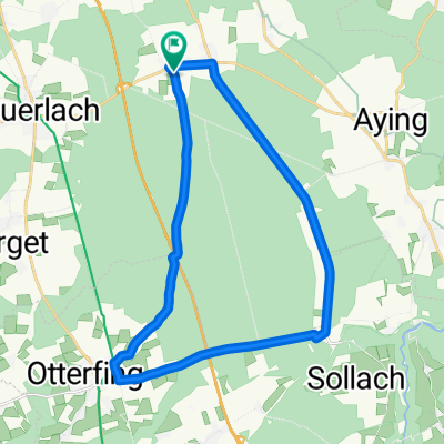
Hofoldinger TT-Runde
A cycling route starting in Brunnthal, Bavaria, Germany.
Overview
About this route
Rundstrecke für zügiges Fahren.
- -:--
- Duration
- 23.9 km
- Distance
- 99 m
- Ascent
- 96 m
- Descent
- ---
- Avg. speed
- ---
- Avg. speed
Route quality
Waytypes & surfaces along the route
Waytypes
Quiet road
12.8 km
(54 %)
Road
9.9 km
(41 %)
Surfaces
Paved
23.9 km
(100 %)
Asphalt
23.9 km
(100 %)
Continue with Bikemap
Use, edit, or download this cycling route
You would like to ride Hofoldinger TT-Runde or customize it for your own trip? Here is what you can do with this Bikemap route:
Free features
- Save this route as favorite or in collections
- Copy & plan your own version of this route
- Sync your route with Garmin or Wahoo
Premium features
Free trial for 3 days, or one-time payment. More about Bikemap Premium.
- Navigate this route on iOS & Android
- Export a GPX / KML file of this route
- Create your custom printout (try it for free)
- Download this route for offline navigation
Discover more Premium features.
Get Bikemap PremiumFrom our community
Other popular routes starting in Brunnthal
- Walchstatt - Ascholding
- Distance
- 82.5 km
- Ascent
- 563 m
- Descent
- 563 m
- Location
- Brunnthal, Bavaria, Germany
- Brunnthal - Deininger Weiher - Brunnthal
- Distance
- 45.8 km
- Ascent
- 405 m
- Descent
- 378 m
- Location
- Brunnthal, Bavaria, Germany
- Brunnthal - Egmating - Altenburg - Zorneding - Brunnthal
- Distance
- 47.8 km
- Ascent
- 346 m
- Descent
- 359 m
- Location
- Brunnthal, Bavaria, Germany
- Deininger Weiher
- Distance
- 38.2 km
- Ascent
- 180 m
- Descent
- 180 m
- Location
- Brunnthal, Bavaria, Germany
- Hofoldinger TT-Runde
- Distance
- 23.9 km
- Ascent
- 99 m
- Descent
- 96 m
- Location
- Brunnthal, Bavaria, Germany
- Rund um Aying
- Distance
- 39.4 km
- Ascent
- 195 m
- Descent
- 195 m
- Location
- Brunnthal, Bavaria, Germany
- Route in Brunnthal
- Distance
- 36 km
- Ascent
- 170 m
- Descent
- 170 m
- Location
- Brunnthal, Bavaria, Germany
- Taubenbergrunde
- Distance
- 66.8 km
- Ascent
- 664 m
- Descent
- 642 m
- Location
- Brunnthal, Bavaria, Germany
Open it in the app