

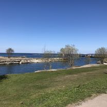
Jussi loodusrada
A cycling route starting in Kuusalu, Harju, Estonia.
Overview
About this route
- -:--
- Duration
- 8.7 km
- Distance
- 54 m
- Ascent
- 57 m
- Descent
- ---
- Avg. speed
- ---
- Max. altitude

Route quality
Waytypes & surfaces along the route
Waytypes
Path
8.2 km
(94 %)
Track
0.4 km
(5 %)
Surfaces
Unpaved
1.6 km
(19 %)
Sand
1.6 km
(19 %)
Undefined
7.1 km
(81 %)
Continue with Bikemap
Use, edit, or download this cycling route
You would like to ride Jussi loodusrada or customize it for your own trip? Here is what you can do with this Bikemap route:
Free features
- Save this route as favorite or in collections
- Copy & plan your own version of this route
- Sync your route with Garmin or Wahoo
Premium features
Free trial for 3 days, or one-time payment. More about Bikemap Premium.
- Navigate this route on iOS & Android
- Export a GPX / KML file of this route
- Create your custom printout (try it for free)
- Download this route for offline navigation
Discover more Premium features.
Get Bikemap PremiumFrom our community
Other popular routes starting in Kuusalu
 Jalgsimatk läbi Kuusalu valla
- Distance
- 146.6 km
- Ascent
- 59 m
- Descent
- 68 m
- Location
- Kuusalu, Harju, Estonia
 Jussi loodusrada
- Distance
- 8.7 km
- Ascent
- 54 m
- Descent
- 57 m
- Location
- Kuusalu, Harju, Estonia
 Kolga1
- Distance
- 50.1 km
- Ascent
- 113 m
- Descent
- 113 m
- Location
- Kuusalu, Harju, Estonia
 Juminda Peninsula Ring (Tsitre)
- Distance
- 33.5 km
- Ascent
- 131 m
- Descent
- 125 m
- Location
- Kuusalu, Harju, Estonia
 Relaxed route in Tallinn
- Distance
- 49.6 km
- Ascent
- 841 m
- Descent
- 862 m
- Location
- Kuusalu, Harju, Estonia
 Kuusalu tee 15 to Rannametsa, Tsitre
- Distance
- 11.6 km
- Ascent
- 23 m
- Descent
- 76 m
- Location
- Kuusalu, Harju, Estonia
 Rattaga külla 2013
- Distance
- 47.1 km
- Ascent
- 166 m
- Descent
- 164 m
- Location
- Kuusalu, Harju, Estonia
 Kuusalu 24-tunni sõit
- Distance
- 236.7 km
- Ascent
- 265 m
- Descent
- 265 m
- Location
- Kuusalu, Harju, Estonia
Open it in the app