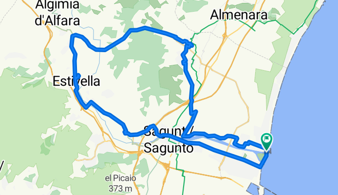
canet bici
A cycling route starting in Canet d'En Berenguer, Valencia, Spain.
Overview
About this route
Canet bike 2 vtas
- -:--
- Duration
- 45.3 km
- Distance
- 246 m
- Ascent
- 241 m
- Descent
- ---
- Avg. speed
- ---
- Max. altitude
Continue with Bikemap
Use, edit, or download this cycling route
You would like to ride canet bici or customize it for your own trip? Here is what you can do with this Bikemap route:
Free features
- Save this route as favorite or in collections
- Copy & plan your own version of this route
- Sync your route with Garmin or Wahoo
Premium features
Free trial for 3 days, or one-time payment. More about Bikemap Premium.
- Navigate this route on iOS & Android
- Export a GPX / KML file of this route
- Create your custom printout (try it for free)
- Download this route for offline navigation
Discover more Premium features.
Get Bikemap PremiumFrom our community
Other popular routes starting in Canet d'En Berenguer
canet bici- Distance
- 45.3 km
- Ascent
- 246 m
- Descent
- 241 m
- Location
- Canet d'En Berenguer, Valencia, Spain
CANET DE BERENGER-PICO DEL AGUILA-CANET- Distance
- 39 km
- Ascent
- 519 m
- Descent
- 516 m
- Location
- Canet d'En Berenguer, Valencia, Spain
De Carrer Periodista Azzati a Carrer Cózar- Distance
- 17.1 km
- Ascent
- 276 m
- Descent
- 361 m
- Location
- Canet d'En Berenguer, Valencia, Spain
Campo y Mar 🚲🚲🚲- Distance
- 19.1 km
- Ascent
- 562 m
- Descent
- 538 m
- Location
- Canet d'En Berenguer, Valencia, Spain
Ruta-Paseo Playas Port de Sagunt- Distance
- 25.9 km
- Ascent
- 6 m
- Descent
- 4 m
- Location
- Canet d'En Berenguer, Valencia, Spain
Puerto-Pico Aguila-Pino Madre-Mola-Puerto- Distance
- 46.2 km
- Ascent
- 724 m
- Descent
- 728 m
- Location
- Canet d'En Berenguer, Valencia, Spain
PUERTO VALL-UXO- Distance
- 50.5 km
- Ascent
- 263 m
- Descent
- 266 m
- Location
- Canet d'En Berenguer, Valencia, Spain
droga z Sagunto do Benidorm- Distance
- 184.9 km
- Ascent
- 1,025 m
- Descent
- 1,006 m
- Location
- Canet d'En Berenguer, Valencia, Spain
Open it in the app


