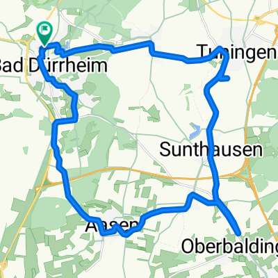
37_Schwenningen – Rottweil – Sulz
- 53.2 km
- 166 m
- 449 m
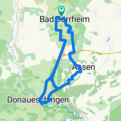
- Bad Dürrheim, Baden-Wurttemberg, Germany
A cycling route starting in Bad Dürrheim, Baden-Wurttemberg, Germany.
Overview
Brigachtal (Kirchdorf) - Bad Dürrheim - Wittmannstal - Hochemmingen - Aasen - Immenhöfe - Donau (near Neudingen) - Pfohren - Donaueschingen (Ziegelhof) - Römerstraße - Brigachtal (Kirchdorf)
created this 5 years ago


Route quality
Track
28.7 km
(65 %)
Quiet road
12.8 km
(29 %)
Paved
38.5 km
(87 %)
Unpaved
4.9 km
(11 %)
Asphalt
38 km
(86 %)
Gravel
4 km
(9 %)
Continue with Bikemap
You would like to ride Über die Baar an die Donau or customize it for your own trip? Here is what you can do with this Bikemap route:
Free trial for 3 days, or one-time payment. More about Bikemap Premium.
Discover more Premium features.
Get Bikemap PremiumFrom our community
Open it in the app