

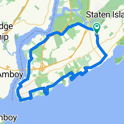
South Shore Loop
A cycling route starting in Staten Island, New York, United States.
Overview
About this route
- -:--
- Duration
- 29.9 km
- Distance
- 112 m
- Ascent
- 111 m
- Descent
- ---
- Avg. speed
- ---
- Max. altitude
Route quality
Waytypes & surfaces along the route
Waytypes
Road
11.6 km
(39 %)
Quiet road
10.2 km
(34 %)
Surfaces
Paved
23 km
(77 %)
Unpaved
0.3 km
(1 %)
Asphalt
22.7 km
(76 %)
Concrete
0.3 km
(1 %)
Continue with Bikemap
Use, edit, or download this cycling route
You would like to ride South Shore Loop or customize it for your own trip? Here is what you can do with this Bikemap route:
Free features
- Save this route as favorite or in collections
- Copy & plan your own version of this route
- Sync your route with Garmin or Wahoo
Premium features
Free trial for 3 days, or one-time payment. More about Bikemap Premium.
- Navigate this route on iOS & Android
- Export a GPX / KML file of this route
- Create your custom printout (try it for free)
- Download this route for offline navigation
Discover more Premium features.
Get Bikemap PremiumFrom our community
Other popular routes starting in Staten Island
 16 Grant Pl, New York to South St, New York
- Distance
- 9.6 km
- Ascent
- 88 m
- Descent
- 85 m
- Location
- Staten Island, New York, United States
 Slow ride in New York
- Distance
- 12.2 km
- Ascent
- 0 m
- Descent
- 3 m
- Location
- Staten Island, New York, United States
 128 Cedar Grove Ave, New York to 65–67 Miller Field, New York
- Distance
- 11.9 km
- Ascent
- 22 m
- Descent
- 19 m
- Location
- Staten Island, New York, United States
 Slow ride in New York
- Distance
- 15.7 km
- Ascent
- 3 m
- Descent
- 3 m
- Location
- Staten Island, New York, United States
 South Shore Loop
- Distance
- 29.9 km
- Ascent
- 112 m
- Descent
- 111 m
- Location
- Staten Island, New York, United States
 Short Home Bike Tour
- Distance
- 4.5 km
- Ascent
- 40 m
- Descent
- 39 m
- Location
- Staten Island, New York, United States
 Klondike Avenue 484 to Hartshorne Drive, Highlands
- Distance
- 71.5 km
- Ascent
- 579 m
- Descent
- 611 m
- Location
- Staten Island, New York, United States
 103 Augusta Ave, New York to Ring Rd, New York
- Distance
- 4.1 km
- Ascent
- 9 m
- Descent
- 19 m
- Location
- Staten Island, New York, United States
Open it in the app