

Chemnitztaltour 1
A cycling route starting in Wittgensdorf, Saxony, Germany.
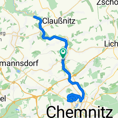
Overview
About this route
Distance: 68.4 Km
Duration: 142 min
Speed: 28.9 Km/h
- -:--
- Duration
- 68.1 km
- Distance
- 480 m
- Ascent
- 480 m
- Descent
- ---
- Avg. speed
- ---
- Max. altitude
Route quality
Waytypes & surfaces along the route
Waytypes
Track
4.8 km
(7 %)
Road
3.4 km
(5 %)
Surfaces
Paved
53.8 km
(79 %)
Unpaved
3.4 km
(5 %)
Asphalt
53.8 km
(79 %)
Gravel
3.4 km
(5 %)
Undefined
10.9 km
(16 %)
Continue with Bikemap
Use, edit, or download this cycling route
You would like to ride Chemnitztaltour 1 or customize it for your own trip? Here is what you can do with this Bikemap route:
Free features
- Save this route as favorite or in collections
- Copy & plan your own version of this route
- Sync your route with Garmin or Wahoo
Premium features
Free trial for 3 days, or one-time payment. More about Bikemap Premium.
- Navigate this route on iOS & Android
- Export a GPX / KML file of this route
- Create your custom printout (try it for free)
- Download this route for offline navigation
Discover more Premium features.
Get Bikemap PremiumFrom our community
Other popular routes starting in Wittgensdorf
 2. DGT Radtour Wittgensdorf - Muldetal - Wittgensdorf
- Distance
- 47.4 km
- Ascent
- 313 m
- Descent
- 314 m
- Location
- Wittgensdorf, Saxony, Germany
 Chemnitztalbahn Diethensdorf - Chemnitz
- Distance
- 38.2 km
- Ascent
- 320 m
- Descent
- 321 m
- Location
- Wittgensdorf, Saxony, Germany
 MTB_Mittweida
- Distance
- 47 km
- Ascent
- 653 m
- Descent
- 652 m
- Location
- Wittgensdorf, Saxony, Germany
 Rabenstein-Oberwald-Wolkenburg-Lunzenau-Burgstädt
- Distance
- 87.8 km
- Ascent
- 806 m
- Descent
- 843 m
- Location
- Wittgensdorf, Saxony, Germany
 Crimmitschauer-Küchwald-Strecke (S01)
- Distance
- 6.6 km
- Ascent
- 97 m
- Descent
- 109 m
- Location
- Wittgensdorf, Saxony, Germany
 Kleine Chemnitztalrunde
- Distance
- 52.6 km
- Ascent
- 314 m
- Descent
- 314 m
- Location
- Wittgensdorf, Saxony, Germany
 RK Rabenstein(Totenstein) - Mittelbach - Neukirchen - Klaffenbach
- Distance
- 43.5 km
- Ascent
- 312 m
- Descent
- 313 m
- Location
- Wittgensdorf, Saxony, Germany
 Chemnitz Tour
- Distance
- 29.8 km
- Ascent
- 232 m
- Descent
- 239 m
- Location
- Wittgensdorf, Saxony, Germany
Open it in the app