


13c - Montefiascone - Monticello Amiata
- 105.5 km
- 1,797 m
- 1,376 m
- Civitella d'Agliano, Lazio, Italy
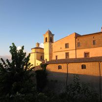
Il Borgo Diffuso di San Michele
A cycling route starting in Civitella d'Agliano, Lazio, Italy.
Overview
This loop route runs along the perimeter of the Valle dei Calanchi, passing through the main villages that border it (Civitella d'Agliano, Castiglione in Teverina, Lubriano, Bagnoregio and Vetriolo).
created this 5 years ago
Part of
6 stages
Route quality
Road
9.7 km
(26 %)
Quiet road
1.5 km
(4 %)
Undefined
26.2 km
(70 %)
Paved
33.6 km
(90 %)
Asphalt
33.6 km
(90 %)
Undefined
3.7 km
(10 %)
Continue with Bikemap
You would like to ride L' Anello della Valle or customize it for your own trip? Here is what you can do with this Bikemap route:
Free trial for 3 days, or one-time payment. More about Bikemap Premium.
Discover more Premium features.
Get Bikemap PremiumFrom our community
Open it in the app


