

Il Borgo Diffuso di San Michele
Verso Civita di Bagnoregio
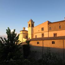
A cycling route starting in Civitella d'Agliano, Lazio, Italy.
Overview
About this route
A route that will allow you to cross the Valle dei Calanchi and reach Civita di Bagnoregio.
- -:--
- Duration
- 38 km
- Distance
- 621 m
- Ascent
- 620 m
- Descent
- ---
- Avg. speed
- ---
- Max. altitude

Part of
Il Borgo Diffuso di San Michele
6 stages
Route quality
Waytypes & surfaces along the route
Waytypes
Road
23.9 km
(63 %)
Quiet road
4.9 km
(13 %)
Undefined
9.1 km
(24 %)
Surfaces
Paved
26.6 km
(70 %)
Asphalt
26.6 km
(70 %)
Undefined
11.4 km
(30 %)
Continue with Bikemap
Use, edit, or download this cycling route
You would like to ride Verso Civita di Bagnoregio or customize it for your own trip? Here is what you can do with this Bikemap route:
Free features
- Save this route as favorite or in collections
- Copy & plan your own version of this route
- Sync your route with Garmin or Wahoo
Premium features
Free trial for 3 days, or one-time payment. More about Bikemap Premium.
- Navigate this route on iOS & Android
- Export a GPX / KML file of this route
- Create your custom printout (try it for free)
- Download this route for offline navigation
Discover more Premium features.
Get Bikemap PremiumFrom our community
Other popular routes starting in Civitella d'Agliano
 Sant'Angelo | Graffignano
- Distance
- 22.9 km
- Ascent
- 500 m
- Descent
- 506 m
- Location
- Civitella d'Agliano, Lazio, Italy
 Strada dell'Ombricolo 4–6, Civitella d'Agliano a Via Sant'Anna 3, Alviano
- Distance
- 5.1 km
- Ascent
- 27 m
- Descent
- 29 m
- Location
- Civitella d'Agliano, Lazio, Italy
 L' Anello della Valle
- Distance
- 37.4 km
- Ascent
- 543 m
- Descent
- 543 m
- Location
- Civitella d'Agliano, Lazio, Italy
 Verso Civita di Bagnoregio
- Distance
- 38 km
- Ascent
- 621 m
- Descent
- 620 m
- Location
- Civitella d'Agliano, Lazio, Italy
 Escursione nella Valle dei Calanchi
- Distance
- 51.4 km
- Ascent
- 871 m
- Descent
- 873 m
- Location
- Civitella d'Agliano, Lazio, Italy
 13c - Montefiascone - Monticello Amiata
- Distance
- 105.5 km
- Ascent
- 1,797 m
- Descent
- 1,376 m
- Location
- Civitella d'Agliano, Lazio, Italy
 La Valle del Tevere
- Distance
- 76.1 km
- Ascent
- 820 m
- Descent
- 827 m
- Location
- Civitella d'Agliano, Lazio, Italy
 13b - Montefiascone - Paganico
- Distance
- 121.7 km
- Ascent
- 1,975 m
- Descent
- 2,020 m
- Location
- Civitella d'Agliano, Lazio, Italy
Open it in the app