

Msg / nil / gembloux / msg
A cycling route starting in Walhain-Saint-Paul, Wallonia, Belgium.
Overview
About this route
- -:--
- Duration
- 49.1 km
- Distance
- 203 m
- Ascent
- 203 m
- Descent
- ---
- Avg. speed
- ---
- Max. altitude

Route quality
Waytypes & surfaces along the route
Waytypes
Quiet road
16.2 km
(33 %)
Road
15.7 km
(32 %)
Surfaces
Paved
25.5 km
(52 %)
Unpaved
2 km
(4 %)
Asphalt
20.1 km
(41 %)
Concrete
5.4 km
(11 %)
Continue with Bikemap
Use, edit, or download this cycling route
You would like to ride Msg / nil / gembloux / msg or customize it for your own trip? Here is what you can do with this Bikemap route:
Free features
- Save this route as favorite or in collections
- Copy & plan your own version of this route
- Sync your route with Garmin or Wahoo
Premium features
Free trial for 3 days, or one-time payment. More about Bikemap Premium.
- Navigate this route on iOS & Android
- Export a GPX / KML file of this route
- Create your custom printout (try it for free)
- Download this route for offline navigation
Discover more Premium features.
Get Bikemap PremiumFrom our community
Other popular routes starting in Walhain-Saint-Paul
 Walhain - Daussoulx - Eghezée
- Distance
- 54 km
- Ascent
- 157 m
- Descent
- 154 m
- Location
- Walhain-Saint-Paul, Wallonia, Belgium
 walhain - eghezee - namur -gembloux - walhain
- Distance
- 81.1 km
- Ascent
- 357 m
- Descent
- 355 m
- Location
- Walhain-Saint-Paul, Wallonia, Belgium
 Supersonic route in Sombreffe
- Distance
- 14.4 km
- Ascent
- 76 m
- Descent
- 79 m
- Location
- Walhain-Saint-Paul, Wallonia, Belgium
 26-09-17
- Distance
- 37.3 km
- Ascent
- 133 m
- Descent
- 136 m
- Location
- Walhain-Saint-Paul, Wallonia, Belgium
 1-10-17
- Distance
- 67.5 km
- Ascent
- 314 m
- Descent
- 313 m
- Location
- Walhain-Saint-Paul, Wallonia, Belgium
 Msg / nil / gembloux / msg
- Distance
- 49.1 km
- Ascent
- 203 m
- Descent
- 203 m
- Location
- Walhain-Saint-Paul, Wallonia, Belgium
 Walhain1
- Distance
- 27 km
- Ascent
- 102 m
- Descent
- 99 m
- Location
- Walhain-Saint-Paul, Wallonia, Belgium
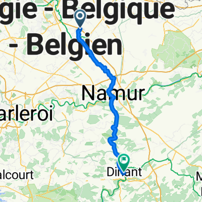 Walhain (afrit 10 E411) -> Dinant (Pont Charles de Gaule)
- Distance
- 56.1 km
- Ascent
- 144 m
- Descent
- 190 m
- Location
- Walhain-Saint-Paul, Wallonia, Belgium
Open it in the app