

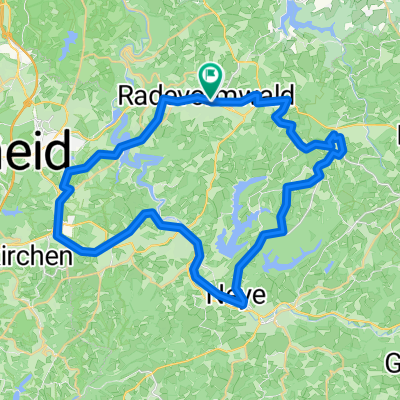
R2 - Entlang der Ülfe und der Wupper
A cycling route starting in Radevormwald, North Rhine-Westphalia, Germany.
Overview
About this route
- -:--
- Duration
- 25.6 km
- Distance
- 276 m
- Ascent
- 276 m
- Descent
- ---
- Avg. speed
- ---
- Max. altitude
Route quality
Waytypes & surfaces along the route
Waytypes
Quiet road
7.2 km
(28 %)
Busy road
6.2 km
(24 %)
Surfaces
Paved
18.9 km
(74 %)
Unpaved
1.9 km
(7 %)
Asphalt
18.9 km
(74 %)
Gravel
1.1 km
(4 %)
Continue with Bikemap
Use, edit, or download this cycling route
You would like to ride R2 - Entlang der Ülfe und der Wupper or customize it for your own trip? Here is what you can do with this Bikemap route:
Free features
- Save this route as favorite or in collections
- Copy & plan your own version of this route
- Sync your route with Garmin or Wahoo
Premium features
Free trial for 3 days, or one-time payment. More about Bikemap Premium.
- Navigate this route on iOS & Android
- Export a GPX / KML file of this route
- Create your custom printout (try it for free)
- Download this route for offline navigation
Discover more Premium features.
Get Bikemap PremiumFrom our community
Other popular routes starting in Radevormwald
 27.11.2010 Krähwinkel 1 Rund um die Wuppertalsperre
- Distance
- 19.8 km
- Ascent
- 259 m
- Descent
- 259 m
- Location
- Radevormwald, North Rhine-Westphalia, Germany
 Adler CTF Herbert
- Distance
- 57.1 km
- Ascent
- 583 m
- Descent
- 583 m
- Location
- Radevormwald, North Rhine-Westphalia, Germany
 Radevormwald-Ennepetalsperre-Halver
- Distance
- 31.6 km
- Ascent
- 328 m
- Descent
- 328 m
- Location
- Radevormwald, North Rhine-Westphalia, Germany
 Rund um das Bismarck Museum 2019
- Distance
- 44.5 km
- Ascent
- 407 m
- Descent
- 406 m
- Location
- Radevormwald, North Rhine-Westphalia, Germany
 Tannenbergweg 3, Radevormwald nach Tannenbergweg 3, Radevormwald
- Distance
- 4.2 km
- Ascent
- 4 m
- Descent
- 23 m
- Location
- Radevormwald, North Rhine-Westphalia, Germany
 R2 - Entlang der Ülfe und der Wupper
- Distance
- 25.6 km
- Ascent
- 276 m
- Descent
- 276 m
- Location
- Radevormwald, North Rhine-Westphalia, Germany
 Runde Röntgenlauf
- Distance
- 62.2 km
- Ascent
- 1,152 m
- Descent
- 1,191 m
- Location
- Radevormwald, North Rhine-Westphalia, Germany
 Rund um die Wuppertalsperre
- Distance
- 23.1 km
- Ascent
- 397 m
- Descent
- 429 m
- Location
- Radevormwald, North Rhine-Westphalia, Germany
Open it in the app