
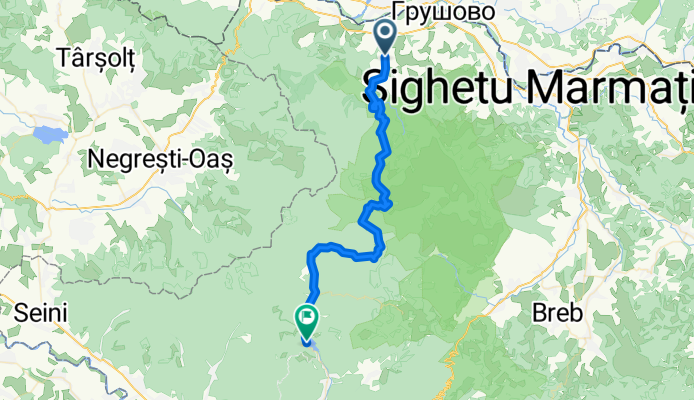
Sapanta - Lacul Firiza
A cycling route starting in Săpânţa, Maramureş County, Romania.
Overview
About this route
- 3 h 26 min
- Duration
- 43 km
- Distance
- 1,563 m
- Ascent
- 1,468 m
- Descent
- 12.6 km/h
- Avg. speed
- 1,093 m
- Max. altitude

Route quality
Waytypes & surfaces along the route
Waytypes
Track
32.6 km
(76 %)
Busy road
4.3 km
(10 %)
Surfaces
Paved
10 km
(23 %)
Unpaved
7.8 km
(18 %)
Asphalt
10 km
(23 %)
Gravel
7.8 km
(18 %)
Undefined
25.1 km
(58 %)
Continue with Bikemap
Use, edit, or download this cycling route
You would like to ride Sapanta - Lacul Firiza or customize it for your own trip? Here is what you can do with this Bikemap route:
Free features
- Save this route as favorite or in collections
- Copy & plan your own version of this route
- Sync your route with Garmin or Wahoo
Premium features
Free trial for 3 days, or one-time payment. More about Bikemap Premium.
- Navigate this route on iOS & Android
- Export a GPX / KML file of this route
- Create your custom printout (try it for free)
- Download this route for offline navigation
Discover more Premium features.
Get Bikemap PremiumFrom our community
Other popular routes starting in Săpânţa
 Sapanta - Piatra Soimului - Cascada Sapanta
- Distance
- 41.6 km
- Ascent
- 1,146 m
- Descent
- 1,144 m
- Location
- Săpânţa, Maramureş County, Romania
 Route Sapanta
- Distance
- 38.3 km
- Ascent
- 868 m
- Descent
- 672 m
- Location
- Săpânţa, Maramureş County, Romania
 Sapanta_Vf.Tiganu_Iapa
- Distance
- 54.3 km
- Ascent
- 1,054 m
- Descent
- 1,056 m
- Location
- Săpânţa, Maramureş County, Romania
 SAPANTA PŁASKOWYŻ
- Distance
- 42 km
- Ascent
- 904 m
- Descent
- 908 m
- Location
- Săpânţa, Maramureş County, Romania
 Sapanta - Viseu de Sus
- Distance
- 76.4 km
- Ascent
- 541 m
- Descent
- 320 m
- Location
- Săpânţa, Maramureş County, Romania
 de la sapanta
- Distance
- 48.5 km
- Ascent
- 903 m
- Descent
- 980 m
- Location
- Săpânţa, Maramureş County, Romania
 Romanian -Adventure MotoRiding
- Distance
- 1,014.9 km
- Ascent
- 9,223 m
- Descent
- 8,425 m
- Location
- Săpânţa, Maramureş County, Romania
 Sapanta - vodopád - pohořím Ignis - Sapanta
- Distance
- 38.5 km
- Ascent
- 733 m
- Descent
- 733 m
- Location
- Săpânţa, Maramureş County, Romania
Open it in the app