
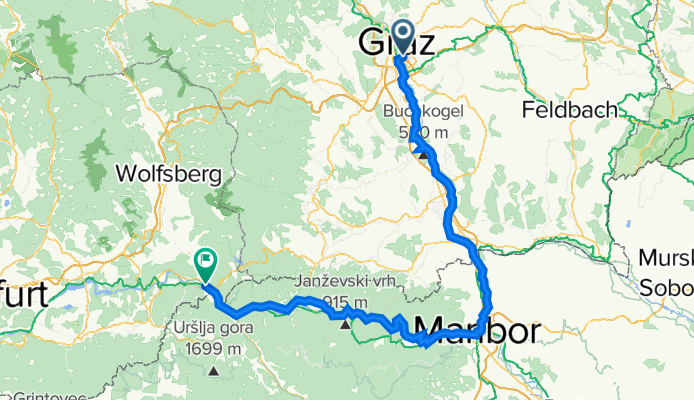
graz - maribor - lavamünd
A cycling route starting in Graz, Styria, Austria.
Overview
About this route
von Graz den Murradweg bis Spielfeld, dann auf der Bundesstrasse bis nach Maribor, weiter über Bundesstrassen bis nach Dravograd, ab dort auf dem Drauradweg nach Lavamünd.
Die Strecke ist sehr flach, lediglich kurze und leichte Hügel zwischen Spielfeld und Dravograd. Der R2 Murradweg ist bestens ausgebaut und wunderbar zu befahren. Auch die Strecke zwischen Spielfeld und Maribor ist in gutem Zustand. Allerdings sei gesagt, dass die Strecke Maribor - Dravograd durchaus stark von LKWs befahren wird, die im slowenischen Fahrstil für Aufregung sorgen! Ebenfalls sind die slowenischen Bundesstrasse zeitweilig in suboptimalem Zustand für Rennräder. Der Drauradweg zwischen Dravograd und Lavamünd ist wieder bestens ausgebaut und mit Freuden zu fahren.
- -:--
- Duration
- 142.6 km
- Distance
- 355 m
- Ascent
- 352 m
- Descent
- ---
- Avg. speed
- ---
- Max. altitude

Route quality
Waytypes & surfaces along the route
Waytypes
Cycleway
25.7 km
(18 %)
Quiet road
24.2 km
(17 %)
Surfaces
Paved
94.1 km
(66 %)
Unpaved
2.9 km
(2 %)
Asphalt
94.1 km
(66 %)
Unpaved (undefined)
1.4 km
(1 %)
Continue with Bikemap
Use, edit, or download this cycling route
You would like to ride graz - maribor - lavamünd or customize it for your own trip? Here is what you can do with this Bikemap route:
Free features
- Save this route as favorite or in collections
- Copy & plan your own version of this route
- Split it into stages to create a multi-day tour
- Sync your route with Garmin or Wahoo
Premium features
Free trial for 3 days, or one-time payment. More about Bikemap Premium.
- Navigate this route on iOS & Android
- Export a GPX / KML file of this route
- Create your custom printout (try it for free)
- Download this route for offline navigation
Discover more Premium features.
Get Bikemap PremiumFrom our community
Other popular routes starting in Graz
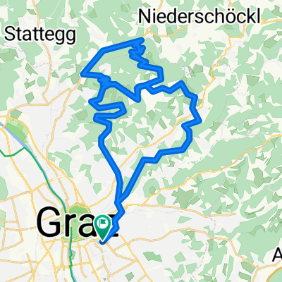 Platte und Hauenstein
- Distance
- 37.9 km
- Ascent
- 860 m
- Descent
- 860 m
- Location
- Graz, Styria, Austria
 Lassnitzhöhe short training route...
- Distance
- 28.5 km
- Ascent
- 330 m
- Descent
- 328 m
- Location
- Graz, Styria, Austria
 Schöne ruhige Rennradrunde
- Distance
- 58.6 km
- Ascent
- 547 m
- Descent
- 544 m
- Location
- Graz, Styria, Austria
 stPETER UND DER WOLFsgraben CLONED FROM ROUTE 1034877
- Distance
- 28.6 km
- Ascent
- 547 m
- Descent
- 547 m
- Location
- Graz, Styria, Austria
 Plabutschrunde mit Ruine Gösting und Thalersee
- Distance
- 30.8 km
- Ascent
- 642 m
- Descent
- 642 m
- Location
- Graz, Styria, Austria
 Graz After-Work-Tour #1
- Distance
- 26.9 km
- Ascent
- 297 m
- Descent
- 294 m
- Location
- Graz, Styria, Austria
 Kleine Hönigtalrunde
- Distance
- 17.2 km
- Ascent
- 277 m
- Descent
- 277 m
- Location
- Graz, Styria, Austria
 Graz - St. Pankrazen - Graz
- Distance
- 70.7 km
- Ascent
- 643 m
- Descent
- 643 m
- Location
- Graz, Styria, Austria
Open it in the app