

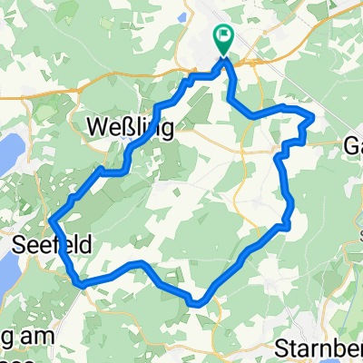
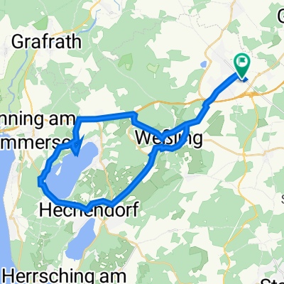
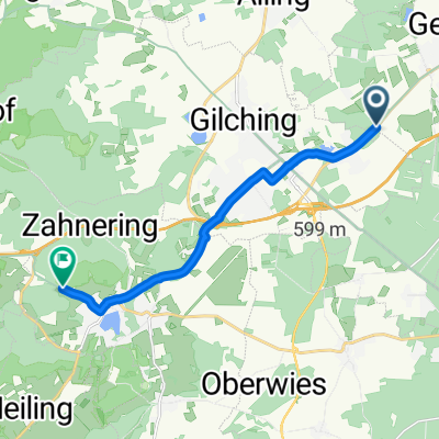
um Starnberger See
A cycling route starting in Gilching, Bavaria, Germany.
Overview
About this route
- 4 h 57 min
- Duration
- 79.3 km
- Distance
- 410 m
- Ascent
- 410 m
- Descent
- 16 km/h
- Avg. speed
- ---
- Max. altitude

Route quality
Waytypes & surfaces along the route
Waytypes
Quiet road
26.2 km
(33 %)
Road
17.5 km
(22 %)
Surfaces
Paved
66.6 km
(84 %)
Unpaved
7.1 km
(9 %)
Asphalt
65.1 km
(82 %)
Gravel
7.1 km
(9 %)
Continue with Bikemap
Use, edit, or download this cycling route
You would like to ride um Starnberger See or customize it for your own trip? Here is what you can do with this Bikemap route:
Free features
- Save this route as favorite or in collections
- Copy & plan your own version of this route
- Sync your route with Garmin or Wahoo
Premium features
Free trial for 3 days, or one-time payment. More about Bikemap Premium.
- Navigate this route on iOS & Android
- Export a GPX / KML file of this route
- Create your custom printout (try it for free)
- Download this route for offline navigation
Discover more Premium features.
Get Bikemap PremiumFrom our community
Other popular routes starting in Gilching
 1. Grob ums Fünf-Seen-Land
- Distance
- 225.8 km
- Ascent
- 1,040 m
- Descent
- 1,040 m
- Location
- Gilching, Bavaria, Germany
 um Starnberger See
- Distance
- 79.3 km
- Ascent
- 410 m
- Descent
- 410 m
- Location
- Gilching, Bavaria, Germany
 Gilching Südrunde
- Distance
- 33.7 km
- Ascent
- 199 m
- Descent
- 196 m
- Location
- Gilching, Bavaria, Germany
 Gilching nach Neuaubing
- Distance
- 15.2 km
- Ascent
- 77 m
- Descent
- 100 m
- Location
- Gilching, Bavaria, Germany
 Hochsteigerweg 17, Gilching nach Hochsteigerweg 17, Gilching
- Distance
- 16.3 km
- Ascent
- 147 m
- Descent
- 147 m
- Location
- Gilching, Bavaria, Germany
 Gilching Wörthsee
- Distance
- 34.5 km
- Ascent
- 311 m
- Descent
- 311 m
- Location
- Gilching, Bavaria, Germany
 Gilching-Ammersee-Peißenberg CLONED FROM ROUTE 382143
- Distance
- 134.1 km
- Ascent
- 731 m
- Descent
- 731 m
- Location
- Gilching, Bavaria, Germany
 St2068 nach Grünsinker Straße
- Distance
- 12.1 km
- Ascent
- 63 m
- Descent
- 69 m
- Location
- Gilching, Bavaria, Germany
Open it in the app