Linachtal/Urachtal
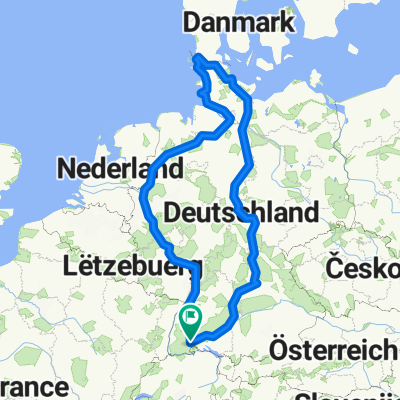
A cycling route starting in Bräunlingen, Baden-Wurttemberg, Germany.
Overview
About this route
Start from Bräunlingen. Black Forest Panorama Cycle Path to Wolterdingen. BregtalstraĂe/L180 to the turn-off for Linachtal. Linachtalsperre, Linach-Ort, several farms, and the first high point of the tour. After 100 Tm and a bridge over the Hintere Breg, the route turns left into the Hohtal. Next high point: Schweizersgrund -> short descent to Neukirch. On the Black Forest Cycle Path along the B500 through Neueck into Grundtal to GĂźtenbach and further down into the valley of the Wild Gutach. At the HexenlochmĂźhle (formerly DreistegenmĂźhle), turn left and follow the Heubach, up to Kaltenherberge via Wolfloch (spring). UrachtalstraĂe to Hammereisenbach, over Steigremmen into a quiet side valley and further to Schollach and Oberbränd. Short detour to Kirnbergsee and roll back to Bräunlingen.
- -:--
- Duration
- 96.8 km
- Distance
- 2,066 m
- Ascent
- 2,068 m
- Descent
- ---
- Avg. speed
- ---
- Max. altitude
Route quality
Waytypes & surfaces along the route
Waytypes
Road
41.6 km
(43 %)
Quiet road
20.3 km
(21 %)
Surfaces
Paved
86.2 km
(89 %)
Asphalt
84.2 km
(87 %)
Paved (undefined)
1.9 km
(2 %)
Undefined
10.6 km
(11 %)
Continue with Bikemap
Use, edit, or download this cycling route
You would like to ride Linachtal/Urachtal or customize it for your own trip? Here is what you can do with this Bikemap route:
Free features
- Save this route as favorite or in collections
- Copy & plan your own version of this route
- Split it into stages to create a multi-day tour
- Sync your route with Garmin or Wahoo
Premium features
Free trial for 3 days, or one-time payment. More about Bikemap Premium.
- Navigate this route on iOS & Android
- Export a GPX / KML file of this route
- Create your custom printout (try it for free)
- Download this route for offline navigation
Discover more Premium features.
Get Bikemap PremiumFrom our community
Other popular routes starting in Bräunlingen
- D2 Braunlingen near Donaueschingen to Fridingen (Germany)
- Distance
- 59.8 km
- Ascent
- 6,215 m
- Descent
- 6,909 m
- Location
- Bräunlingen, Baden-Wurttemberg, Germany
- Tannheim-Zindelstein-HĂźfingen-Brigachtal-Tannheim
- Distance
- 34.2 km
- Ascent
- 245 m
- Descent
- 244 m
- Location
- Bräunlingen, Baden-Wurttemberg, Germany
- Immendingen - Freiburg
- Distance
- 54.8 km
- Ascent
- 564 m
- Descent
- 943 m
- Location
- Bräunlingen, Baden-Wurttemberg, Germany
- D2a Braunlingen near Donaueshingen to Tuttlingen
- Distance
- 44.3 km
- Ascent
- 85 m
- Descent
- 133 m
- Location
- Bräunlingen, Baden-Wurttemberg, Germany
- Halbmarathon Bräunlingen
- Distance
- 21.6 km
- Ascent
- 201 m
- Descent
- 200 m
- Location
- Bräunlingen, Baden-Wurttemberg, Germany
- Bäunlingen - Donaueschingen - Tuttlingen
- Distance
- 40.2 km
- Ascent
- 109 m
- Descent
- 153 m
- Location
- Bräunlingen, Baden-Wurttemberg, Germany
- Linachtal/Urachtal
- Distance
- 96.8 km
- Ascent
- 2,066 m
- Descent
- 2,068 m
- Location
- Bräunlingen, Baden-Wurttemberg, Germany
- Gauchachrunde ab Mundelfingen 11,7 Km
- Distance
- 11.7 km
- Ascent
- 254 m
- Descent
- 256 m
- Location
- Bräunlingen, Baden-Wurttemberg, Germany
Open it in the app