

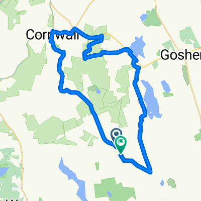
East Cornwall to Lime Rock and back to West Cornwall
A cycling route starting in Litchfield, Connecticut, United States.
Overview
About this route
This is the route that Will took July 4th weekend. Almost 28 miles! Good thing Laurie picked you up.
- -:--
- Duration
- 44.9 km
- Distance
- 389 m
- Ascent
- 580 m
- Descent
- ---
- Avg. speed
- ---
- Max. altitude
Route quality
Waytypes & surfaces along the route
Waytypes
Quiet road
13.9 km
(31 %)
Road
13 km
(29 %)
Surfaces
Paved
30.1 km
(67 %)
Unpaved
1.3 km
(3 %)
Asphalt
30.1 km
(67 %)
Gravel
1.3 km
(3 %)
Undefined
13.5 km
(30 %)
Continue with Bikemap
Use, edit, or download this cycling route
You would like to ride East Cornwall to Lime Rock and back to West Cornwall or customize it for your own trip? Here is what you can do with this Bikemap route:
Free features
- Save this route as favorite or in collections
- Copy & plan your own version of this route
- Sync your route with Garmin or Wahoo
Premium features
Free trial for 3 days, or one-time payment. More about Bikemap Premium.
- Navigate this route on iOS & Android
- Export a GPX / KML file of this route
- Create your custom printout (try it for free)
- Download this route for offline navigation
Discover more Premium features.
Get Bikemap PremiumFrom our community
Other popular routes starting in Litchfield
 test
test- Distance
- 77 km
- Ascent
- 717 m
- Descent
- 834 m
- Location
- Litchfield, Connecticut, United States
 litchfield 75
- Distance
- 118.9 km
- Ascent
- 940 m
- Descent
- 940 m
- Location
- Litchfield, Connecticut, United States
 Route to 127–199 Webster Rd, Morris
- Distance
- 4.8 km
- Ascent
- 80 m
- Descent
- 76 m
- Location
- Litchfield, Connecticut, United States
 The Goshen loop
- Distance
- 16.4 km
- Ascent
- 198 m
- Descent
- 193 m
- Location
- Litchfield, Connecticut, United States
 443 Torrington Rd, Litchfield to 443 Torrington Rd, Litchfield
- Distance
- 10 km
- Ascent
- 147 m
- Descent
- 146 m
- Location
- Litchfield, Connecticut, United States
 Route to 342 Main St, Great Barrington
- Distance
- 65.4 km
- Ascent
- 915 m
- Descent
- 1,019 m
- Location
- Litchfield, Connecticut, United States
 Ives Road 45, Goshen to West Street 46, Litchfield
- Distance
- 19.7 km
- Ascent
- 73 m
- Descent
- 128 m
- Location
- Litchfield, Connecticut, United States
 Route in Litchfield
- Distance
- 31.7 km
- Ascent
- 646 m
- Descent
- 639 m
- Location
- Litchfield, Connecticut, United States
Open it in the app