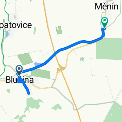
- 11.1 km
- 40 m
- 41 m
- Blučina, South Moravian, Czechia
Tři státy - 80 až 170km
A cycling route starting in Blučina, South Moravian, Czechia.
Overview
About this route
The route is led, if possible, away from the main roads. From Dolní Dunajovice, you can ride to Mikulov on a nice asphalt road that runs parallel to the E461. Then in Austria there is also a service road along the E461, but most of the time it has a bad surface. With a road bike, it’s better to ride directly on the E461. Another place with more traffic is road number 2 in Slovakia. There you just have to endure those 7 km. During the ride, you can decide at three points whether to shorten the route or continue for the full 170 km.
- -:--
- Duration
- 171.8 km
- Distance
- 336 m
- Ascent
- 335 m
- Descent
- ---
- Avg. speed
- ---
- Max. altitude
created this 15 years ago
Route quality
Waytypes & surfaces along the route
Waytypes
Road
70.4 km
41 %
Quiet road
12 km
7 %
Surfaces
Paved
135.7 km
(79 %)
Asphalt
134 km
78 %
Paved (undefined)
1.7 km
1 %
Undefined
36.1 km
21 %
Route highlights
Points of interest along the route
Point of interest after 54.5 km
Možnost zkratky směr Valtice a přes Lednici domů...
Point of interest after 62.6 km
Možnost zkratky směr Břeclav a přes Lednici domů (hned za hranicí je vlevo dobrá hospoda).
Continue with Bikemap
Use, edit, or download this cycling route
You would like to ride Tři státy - 80 až 170km or customize it for your own trip? Here is what you can do with this Bikemap route:
Free features
- Save this route as favorite or in collections
- Copy & plan your own version of this route
- Split it into stages to create a multi-day tour
- Sync your route with Garmin or Wahoo
Premium features
Free trial for 3 days, or one-time payment. More about Bikemap Premium.
- Navigate this route on iOS & Android
- Export a GPX / KML file of this route
- Create your custom printout (try it for free)
- Download this route for offline navigation
Discover more Premium features.
Get Bikemap PremiumFrom our community
Other popular routes starting in Blučina
- Blučina-Měnín
- Do Rakouska přes kopec
- 130.6 km
- 489 m
- 489 m
- Blučina, South Moravian, Czechia
- nedělní výšlap
- 44.4 km
- 360 m
- 336 m
- Blučina, South Moravian, Czechia
- Moje obvyklá padesátka
- 49.8 km
- 213 m
- 213 m
- Blučina, South Moravian, Czechia
- Route to Za Mostem, Nosislav
- 6.2 km
- 66 m
- 236 m
- Blučina, South Moravian, Czechia
- Tři státy - 80 až 170km
- 171.8 km
- 336 m
- 335 m
- Blučina, South Moravian, Czechia
- Kopce jižní moravy: Z Blučiny na Výhon
- 3.2 km
- 166 m
- 20 m
- Blučina, South Moravian, Czechia
- Zvlněná
- 74 km
- 422 m
- 422 m
- Blučina, South Moravian, Czechia
Open it in the app


