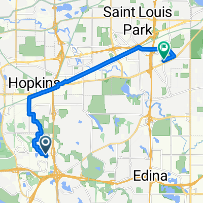
Edina LakeSt River Minnehaha Loop
A cycling route starting in Edina, Minnesota, United States of America.
Overview
About this route
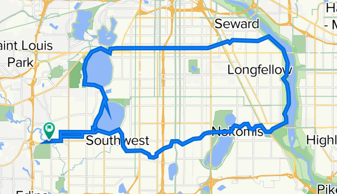
Wooddale Park Edina to lower Lake Harriet. Get on Lake bike path to Upper Calhoun Lake. Catch the MIdtown Greenway bike route to the MIssissippi River then head south to Minnehaha Falls and catch the Minnehaha Creek trail back to Lake Hariet. Follow lake Harriet bike trail bake to Thomas Ave South and back to Wooddale Park at 50th and Wooddale.
- -:--
- Duration
- 34.6 km
- Distance
- 61 m
- Ascent
- 63 m
- Descent
- ---
- Avg. speed
- ---
- Max. altitude
Route quality
Waytypes & surfaces along the route
Waytypes
Cycleway
26.3 km
(76 %)
Quiet road
6.3 km
(18 %)
Surfaces
Paved
26.7 km
(77 %)
Unpaved
0 km
(<1 %)
Asphalt
24.1 km
(70 %)
Paved (undefined)
2.3 km
(7 %)
Continue with Bikemap
Use, edit, or download this cycling route
You would like to ride Edina LakeSt River Minnehaha Loop or customize it for your own trip? Here is what you can do with this Bikemap route:
Free features
- Save this route as favorite or in collections
- Copy & plan your own version of this route
- Sync your route with Garmin or Wahoo
Premium features
Free trial for 3 days, or one-time payment. More about Bikemap Premium.
- Navigate this route on iOS & Android
- Export a GPX / KML file of this route
- Create your custom printout (try it for free)
- Download this route for offline navigation
Discover more Premium features.
Get Bikemap PremiumFrom our community
Other popular routes starting in Edina
- B2B00708 55410 > 55406 via Xerxes Ave, Midtown Greenway
- Distance
- 12.5 km
- Ascent
- 32 m
- Descent
- 41 m
- Location
- Edina, Minnesota, United States of America
- via Midtown Greenway, Park Ave
- Distance
- 13.8 km
- Ascent
- 30 m
- Descent
- 35 m
- Location
- Edina, Minnesota, United States of America
- Lake Harriet - Calhoun - Greenway - River - Creek
- Distance
- 28.6 km
- Ascent
- 90 m
- Descent
- 96 m
- Location
- Edina, Minnesota, United States of America
- Usual Commute, updated May 2013
- Distance
- 16.2 km
- Ascent
- 100 m
- Descent
- 107 m
- Location
- Edina, Minnesota, United States of America
- Fun Lake Ride
- Distance
- 57 km
- Ascent
- 104 m
- Descent
- 103 m
- Location
- Edina, Minnesota, United States of America
- B2B00676 55439 > 55403 via Blake Rd, Kenilworth Trail
- Distance
- 17.9 km
- Ascent
- 69 m
- Descent
- 77 m
- Location
- Edina, Minnesota, United States of America
- Minn River/Hyland Preserve
- Distance
- 33.1 km
- Ascent
- 175 m
- Descent
- 195 m
- Location
- Edina, Minnesota, United States of America
- Commute Via Creek
- Distance
- 18.3 km
- Ascent
- 107 m
- Descent
- 116 m
- Location
- Edina, Minnesota, United States of America
Open it in the app