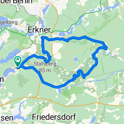
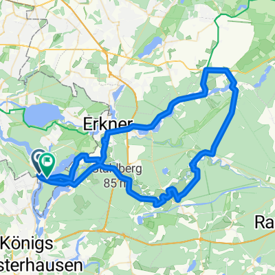
Schmöckwitz - Mönchwinkel - Grünheide
A cycling route starting in Schmöckwitz, Land Berlin, Germany.
Overview
About this route
- -:--
- Duration
- 69.9 km
- Distance
- 138 m
- Ascent
- 133 m
- Descent
- ---
- Avg. speed
- ---
- Avg. speed
Route quality
Waytypes & surfaces along the route
Waytypes
Path
15.8 km
(23 %)
Busy road
14 km
(20 %)
Surfaces
Paved
57.2 km
(82 %)
Unpaved
10.2 km
(15 %)
Asphalt
46.3 km
(66 %)
Paving stones
8.5 km
(12 %)
Continue with Bikemap
Use, edit, or download this cycling route
You would like to ride Schmöckwitz - Mönchwinkel - Grünheide or customize it for your own trip? Here is what you can do with this Bikemap route:
Free features
- Save this route as favorite or in collections
- Copy & plan your own version of this route
- Sync your route with Garmin or Wahoo
Premium features
Free trial for 3 days, or one-time payment. More about Bikemap Premium.
- Navigate this route on iOS & Android
- Export a GPX / KML file of this route
- Create your custom printout (try it for free)
- Download this route for offline navigation
Discover more Premium features.
Get Bikemap PremiumFrom our community
Other popular routes starting in Schmöckwitz
- Schmöckwitz - Mönchwinkel - Grünheide
- Distance
- 69.9 km
- Ascent
- 138 m
- Descent
- 133 m
- Location
- Schmöckwitz, Land Berlin, Germany
- Niederheide-rund
- Distance
- 42.7 km
- Ascent
- 124 m
- Descent
- 124 m
- Location
- Schmöckwitz, Land Berlin, Germany
- Adlergestell 766, Berlin nach Neu Zittauer Straße, Königs Wusterhausen
- Distance
- 13.1 km
- Ascent
- 3 m
- Descent
- 0 m
- Location
- Schmöckwitz, Land Berlin, Germany
- Alt-Köpenick (Dahme und See) Teil2
- Distance
- 45.8 km
- Ascent
- 97 m
- Descent
- 98 m
- Location
- Schmöckwitz, Land Berlin, Germany
- Crossfondo2014
- Distance
- 39.9 km
- Ascent
- 143 m
- Descent
- 147 m
- Location
- Schmöckwitz, Land Berlin, Germany
- Berg und Tal - Schmöckwitz ubd Schulzendorf
- Distance
- 15.7 km
- Ascent
- 27 m
- Descent
- 28 m
- Location
- Schmöckwitz, Land Berlin, Germany
- Fürstenwalde-Wernsdorf-Fürstenwalde
- Distance
- 69.2 km
- Ascent
- 102 m
- Descent
- 103 m
- Location
- Schmöckwitz, Land Berlin, Germany
- Rundkurs Müggelberg - Grünau
- Distance
- 35.1 km
- Ascent
- 175 m
- Descent
- 174 m
- Location
- Schmöckwitz, Land Berlin, Germany
Open it in the app