

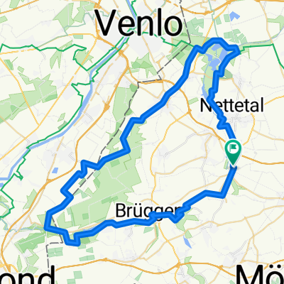
Lobberich-Kempen-aldekerk-Wankum-Lobberich
A cycling route starting in Nettetal, North Rhine-Westphalia, Germany.
Overview
About this route
- -:--
- Duration
- 45.7 km
- Distance
- 111 m
- Ascent
- 113 m
- Descent
- ---
- Avg. speed
- ---
- Max. altitude
Route quality
Waytypes & surfaces along the route
Waytypes
Path
27 km
(59 %)
Busy road
6.5 km
(14 %)
Surfaces
Paved
44.3 km
(97 %)
Unpaved
0.1 km
(<1 %)
Asphalt
40.6 km
(89 %)
Paving stones
2.6 km
(6 %)
Continue with Bikemap
Use, edit, or download this cycling route
You would like to ride Lobberich-Kempen-aldekerk-Wankum-Lobberich or customize it for your own trip? Here is what you can do with this Bikemap route:
Free features
- Save this route as favorite or in collections
- Copy & plan your own version of this route
- Sync your route with Garmin or Wahoo
Premium features
Free trial for 3 days, or one-time payment. More about Bikemap Premium.
- Navigate this route on iOS & Android
- Export a GPX / KML file of this route
- Create your custom printout (try it for free)
- Download this route for offline navigation
Discover more Premium features.
Get Bikemap PremiumFrom our community
Other popular routes starting in Nettetal
 Schaag - Hariksee - Heidweiher - Schaag
- Distance
- 20.7 km
- Ascent
- 82 m
- Descent
- 83 m
- Location
- Nettetal, North Rhine-Westphalia, Germany
 Unbenannte Route
- Distance
- 362.8 km
- Ascent
- 553 m
- Descent
- 556 m
- Location
- Nettetal, North Rhine-Westphalia, Germany
 GL`s Seen-MTB-Strecke
- Distance
- 33.1 km
- Ascent
- 124 m
- Descent
- 124 m
- Location
- Nettetal, North Rhine-Westphalia, Germany
 Nette Route
- Distance
- 28.8 km
- Ascent
- 57 m
- Descent
- 57 m
- Location
- Nettetal, North Rhine-Westphalia, Germany
 Nettetalrunde
- Distance
- 30.8 km
- Ascent
- 101 m
- Descent
- 104 m
- Location
- Nettetal, North Rhine-Westphalia, Germany
 Lobberich,Herongen,VenloerHeide,Krickenbeck,Lobberich
- Distance
- 26 km
- Ascent
- 55 m
- Descent
- 56 m
- Location
- Nettetal, North Rhine-Westphalia, Germany
 Heinz Route 1
- Distance
- 18.4 km
- Ascent
- 61 m
- Descent
- 61 m
- Location
- Nettetal, North Rhine-Westphalia, Germany
 Heide-Seen Tour (Nettetal)
- Distance
- 59.3 km
- Ascent
- 106 m
- Descent
- 106 m
- Location
- Nettetal, North Rhine-Westphalia, Germany
Open it in the app