Remse
- 38.4 km
- 288 m
- 262 m
- Jückelberg, Thuringia, Germany
A cycling route starting in Jückelberg, Thuringia, Germany.
Overview
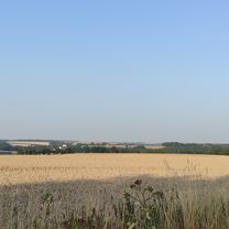
Bike tour Penig-Burgstädt-Flöha-Pockau-Sorgau-Ansprung
created this 15 years ago
Route quality
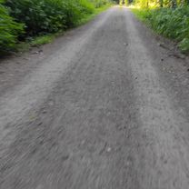
Quiet road
19 km
(24 %)
Road
13.4 km
(17 %)
Paved
58.5 km
(74 %)
Unpaved
3.2 km
(4 %)
Asphalt
57.7 km
(73 %)
Paved (undefined)
0.8 km
(1 %)
Continue with Bikemap
You would like to ride Niedersteinbach-Ansprung_I or customize it for your own trip? Here is what you can do with this Bikemap route:
Free trial for 3 days, or one-time payment. More about Bikemap Premium.
Discover more Premium features.
Get Bikemap PremiumFrom our community
Open it in the app