

Aggtelek-Zemplén kör
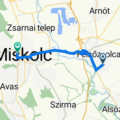
A cycling route starting in Felsőzsolca, Borsod-Abauj Zemplen county, Hungary.
Overview
About this route
2020 tavaszán
- -:--
- Duration
- 344.6 km
- Distance
- 1,655 m
- Ascent
- 1,653 m
- Descent
- ---
- Avg. speed
- ---
- Max. altitude

Route quality
Waytypes & surfaces along the route
Waytypes
Busy road
240.7 km
(70 %)
Track
33.4 km
(10 %)
Surfaces
Paved
97.9 km
(28 %)
Unpaved
21.5 km
(6 %)
Asphalt
94.6 km
(27 %)
Gravel
12.8 km
(4 %)
Route highlights
Points of interest along the route
Accommodation after 70 km
Continue with Bikemap
Use, edit, or download this cycling route
You would like to ride Aggtelek-Zemplén kör or customize it for your own trip? Here is what you can do with this Bikemap route:
Free features
- Save this route as favorite or in collections
- Copy & plan your own version of this route
- Split it into stages to create a multi-day tour
- Sync your route with Garmin or Wahoo
Premium features
Free trial for 3 days, or one-time payment. More about Bikemap Premium.
- Navigate this route on iOS & Android
- Export a GPX / KML file of this route
- Create your custom printout (try it for free)
- Download this route for offline navigation
Discover more Premium features.
Get Bikemap PremiumFrom our community
Other popular routes starting in Felsőzsolca
 Fonoda utca 54., Miskolc to Fonoda utca 56., Miskolc
- Distance
- 3.4 km
- Ascent
- 0 m
- Descent
- 0 m
- Location
- Felsőzsolca, Borsod-Abauj Zemplen county, Hungary
 BAZ - 2020 április 1. nap
- Distance
- 70.2 km
- Ascent
- 319 m
- Descent
- 206 m
- Location
- Felsőzsolca, Borsod-Abauj Zemplen county, Hungary
 Aggtelek-Zemplén kör
- Distance
- 344.6 km
- Ascent
- 1,655 m
- Descent
- 1,653 m
- Location
- Felsőzsolca, Borsod-Abauj Zemplen county, Hungary
 Felsőzsolca, Szent István u., Miskolc to Unnamed Road, Miskolc
- Distance
- 22 km
- Ascent
- 232 m
- Descent
- 66 m
- Location
- Felsőzsolca, Borsod-Abauj Zemplen county, Hungary
 Hősök tere 26, Felsőzsolca to Hősök tere 26, Felsőzsolca
- Distance
- 13 km
- Ascent
- 60 m
- Descent
- 61 m
- Location
- Felsőzsolca, Borsod-Abauj Zemplen county, Hungary
 Decathlon-Hell
- Distance
- 93.1 km
- Ascent
- 253 m
- Descent
- 246 m
- Location
- Felsőzsolca, Borsod-Abauj Zemplen county, Hungary
 Magyarország Hegyei 9. szakasz
- Distance
- 121.4 km
- Ascent
- 1,395 m
- Descent
- 1,349 m
- Location
- Felsőzsolca, Borsod-Abauj Zemplen county, Hungary
 Arany János utca 2/2., Felsőzsolca to Horváth Lajos utca 2., Miskolc
- Distance
- 8 km
- Ascent
- 25 m
- Descent
- 9 m
- Location
- Felsőzsolca, Borsod-Abauj Zemplen county, Hungary
Open it in the app