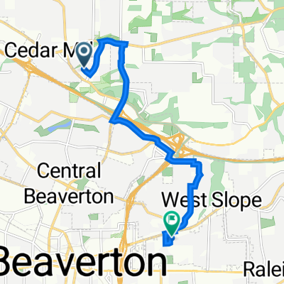
Cedar Mill / Aloha / Beaverton Loop
A cycling route starting in Cedar Mill, Oregon, United States of America.
Overview
About this route
- -:--
- Duration
- 20.9 km
- Distance
- 147 m
- Ascent
- 147 m
- Descent
- ---
- Avg. speed
- ---
- Avg. speed
Route quality
Waytypes & surfaces along the route
Waytypes
Busy road
14.8 km
(71 %)
Quiet road
2.9 km
(14 %)
Surfaces
Paved
18.6 km
(89 %)
Asphalt
15.5 km
(74 %)
Concrete
2.7 km
(13 %)
Continue with Bikemap
Use, edit, or download this cycling route
You would like to ride Cedar Mill / Aloha / Beaverton Loop or customize it for your own trip? Here is what you can do with this Bikemap route:
Free features
- Save this route as favorite or in collections
- Copy & plan your own version of this route
- Sync your route with Garmin or Wahoo
Premium features
Free trial for 3 days, or one-time payment. More about Bikemap Premium.
- Navigate this route on iOS & Android
- Export a GPX / KML file of this route
- Create your custom printout (try it for free)
- Download this route for offline navigation
Discover more Premium features.
Get Bikemap PremiumFrom our community
Other popular routes starting in Cedar Mill
- [77]Laurel-FG-NPlains
- Distance
- 124.6 km
- Ascent
- 561 m
- Descent
- 561 m
- Location
- Cedar Mill, Oregon, United States of America
- Bauer Crest, Orenco, Powerlines Loop
- Distance
- 24.4 km
- Ascent
- 132 m
- Descent
- 133 m
- Location
- Cedar Mill, Oregon, United States of America
- Relaxed route in Portland
- Distance
- 6.1 km
- Ascent
- 18 m
- Descent
- 330 m
- Location
- Cedar Mill, Oregon, United States of America
- The route I did 6/27/23
- Distance
- 20.6 km
- Ascent
- 215 m
- Descent
- 217 m
- Location
- Cedar Mill, Oregon, United States of America
- jake's PITA route 6/28/23
- Distance
- 25.5 km
- Ascent
- 286 m
- Descent
- 287 m
- Location
- Cedar Mill, Oregon, United States of America
- Cedar Mill / Aloha / Beaverton Loop
- Distance
- 20.9 km
- Ascent
- 147 m
- Descent
- 147 m
- Location
- Cedar Mill, Oregon, United States of America
- 12.42
- Distance
- 21.4 km
- Ascent
- 363 m
- Descent
- 365 m
- Location
- Cedar Mill, Oregon, United States of America
- Cedar Mill, Corn Pass, Rock Creek Trail
- Distance
- 20.6 km
- Ascent
- 176 m
- Descent
- 176 m
- Location
- Cedar Mill, Oregon, United States of America
Open it in the app