- 16.5 km
- 111 m
- 117 m
- Concepción, Región del Biobío, Chile
Concepción - Pichilemu
A cycling route starting in Concepción, Región del Biobío, Chile.
Overview
About this route
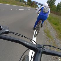
This route was completed in 7 days, in September 2008. It averaged 60 km daily in a relaxed manner since the main idea was to get to know the areas adjacent to the route. We camped in tents, always asking for authorization from the owners of the house or land to set up. The route at the beginning consists of around 100 km of gravel (steep forest roads), then entering the VII Region the pavement begins just before Constitución.
A highly recommended route due to the variety of landscapes one can discover, as well as the truly interesting and supportive people.
- -:--
- Duration
- 416.6 km
- Distance
- 2,027 m
- Ascent
- 2,038 m
- Descent
- ---
- Avg. speed
- ---
- Max. altitude
created this 15 years ago
Route highlights
Points of interest along the route
Point of interest after 358.1 km
Excelente vista simultanea del océano y el Lago Vichuquén
Continue with Bikemap
Use, edit, or download this cycling route
You would like to ride Concepción - Pichilemu or customize it for your own trip? Here is what you can do with this Bikemap route:
Free features
- Save this route as favorite or in collections
- Copy & plan your own version of this route
- Split it into stages to create a multi-day tour
- Sync your route with Garmin or Wahoo
Premium features
Free trial for 3 days, or one-time payment. More about Bikemap Premium.
- Navigate this route on iOS & Android
- Export a GPX / KML file of this route
- Create your custom printout (try it for free)
- Download this route for offline navigation
Discover more Premium features.
Get Bikemap PremiumFrom our community
Other popular routes starting in Concepción
- -36.821, -73.043 a -36.821, -73.043
- solo hazlo
- 11.1 km
- 66 m
- 61 m
- Concepción, Región del Biobío, Chile
- una vez más
- 20.2 km
- 131 m
- 140 m
- Concepción, Región del Biobío, Chile
- se guarda o no
- 5 km
- 22 m
- 41 m
- Concepción, Región del Biobío, Chile
- Ruta desde Avenida Los Presidentes
- 3.3 km
- 22 m
- 67 m
- Concepción, Región del Biobío, Chile
- Laguna Chica - Mirador
- 19 km
- 501 m
- 500 m
- Concepción, Región del Biobío, Chile
- Ruta desde Volcán Ollagüe 1er descanso
- 13 km
- 139 m
- 89 m
- Concepción, Región del Biobío, Chile
- morPaseo tranquilo
- 5.5 km
- 19 m
- 47 m
- Concepción, Región del Biobío, Chile
Open it in the app


