

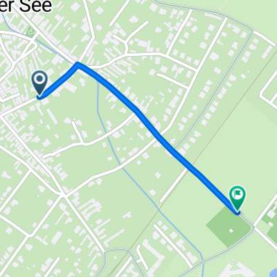
Doki
Doki-Wulkaprodersd.-Müllendorf-Loretto-Hof-Doki
A cycling route starting in Donnerskirchen, Burgenland, Austria.
Overview
About this route
- -:--
- Duration
- 62.7 km
- Distance
- 501 m
- Ascent
- 500 m
- Descent
- ---
- Avg. speed
- ---
- Max. altitude

Part of
Doki
12 stages
Route quality
Waytypes & surfaces along the route
Waytypes
Track
24.4 km
(39 %)
Quiet road
18.8 km
(30 %)
Surfaces
Paved
54.5 km
(87 %)
Unpaved
4.4 km
(7 %)
Asphalt
52.6 km
(84 %)
Ground
2.5 km
(4 %)
Continue with Bikemap
Use, edit, or download this cycling route
You would like to ride Doki-Wulkaprodersd.-Müllendorf-Loretto-Hof-Doki or customize it for your own trip? Here is what you can do with this Bikemap route:
Free features
- Save this route as favorite or in collections
- Copy & plan your own version of this route
- Sync your route with Garmin or Wahoo
Premium features
Free trial for 3 days, or one-time payment. More about Bikemap Premium.
- Navigate this route on iOS & Android
- Export a GPX / KML file of this route
- Create your custom printout (try it for free)
- Download this route for offline navigation
Discover more Premium features.
Get Bikemap PremiumFrom our community
Other popular routes starting in Donnerskirchen
 Bodenzeile - Campingplatz
- Distance
- 1.1 km
- Ascent
- 0 m
- Descent
- 7 m
- Location
- Donnerskirchen, Burgenland, Austria
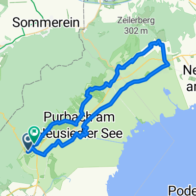
 Purbach_RM
- Distance
- 40.2 km
- Ascent
- 437 m
- Descent
- 437 m
- Location
- Donnerskirchen, Burgenland, Austria
 Wiener Straße - Budapester Straße
- Distance
- 92.5 km
- Ascent
- 669 m
- Descent
- 767 m
- Location
- Donnerskirchen, Burgenland, Austria
 Von Purbach nach Forchtenstein
- Distance
- 102.6 km
- Ascent
- 584 m
- Descent
- 584 m
- Location
- Donnerskirchen, Burgenland, Austria
 Seibersdorfrunde
- Distance
- 47.8 km
- Ascent
- 472 m
- Descent
- 471 m
- Location
- Donnerskirchen, Burgenland, Austria
 maco 28.7.18
- Distance
- 61.5 km
- Ascent
- 1,342 m
- Descent
- 1,335 m
- Location
- Donnerskirchen, Burgenland, Austria
 Kirschblütenradweg Donnerskirchen nach Jois und zurück
- Distance
- 42.6 km
- Ascent
- 276 m
- Descent
- 321 m
- Location
- Donnerskirchen, Burgenland, Austria
 Donnerskirchen - Jois
- Distance
- 38 km
- Ascent
- 247 m
- Descent
- 258 m
- Location
- Donnerskirchen, Burgenland, Austria
Open it in the app