Annaberg - Fichtelberg - Annaberg
A cycling route starting in Annaberg-Buchholz, Saxony, Germany.
Overview
About this route
- -:--
- Duration
- 43.2 km
- Distance
- 713 m
- Ascent
- 669 m
- Descent
- ---
- Avg. speed
- 1,187 m
- Avg. speed
Route quality
Waytypes & surfaces along the route
Waytypes
Track
20.1 km
(46 %)
Busy road
11.7 km
(27 %)
Surfaces
Paved
26.7 km
(62 %)
Unpaved
13 km
(30 %)
Asphalt
24.9 km
(58 %)
Gravel
6.9 km
(16 %)
Continue with Bikemap
Use, edit, or download this cycling route
You would like to ride Annaberg - Fichtelberg - Annaberg or customize it for your own trip? Here is what you can do with this Bikemap route:
Free features
- Save this route as favorite or in collections
- Copy & plan your own version of this route
- Sync your route with Garmin or Wahoo
Premium features
Free trial for 3 days, or one-time payment. More about Bikemap Premium.
- Navigate this route on iOS & Android
- Export a GPX / KML file of this route
- Create your custom printout (try it for free)
- Download this route for offline navigation
Discover more Premium features.
Get Bikemap PremiumFrom our community
Other popular routes starting in Annaberg-Buchholz
- Buchholz-Crottendorf-Fichtleberg-Sehmatal-Buchholz
- Distance
- 40.2 km
- Ascent
- 762 m
- Descent
- 761 m
- Location
- Annaberg-Buchholz, Saxony, Germany
- Annaberg - Fichtelberg - Annaberg
- Distance
- 43.2 km
- Ascent
- 713 m
- Descent
- 669 m
- Location
- Annaberg-Buchholz, Saxony, Germany
- Annaberg - Hammerunterwiesenthal
- Distance
- 37.3 km
- Ascent
- 356 m
- Descent
- 357 m
- Location
- Annaberg-Buchholz, Saxony, Germany
- Cranzahl Talsperrentour
- Distance
- 27.5 km
- Ascent
- 367 m
- Descent
- 383 m
- Location
- Annaberg-Buchholz, Saxony, Germany
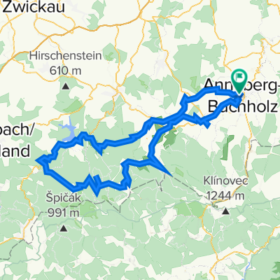
- Annaberg Landring-Radeln
- Distance
- 63.1 km
- Ascent
- 936 m
- Descent
- 936 m
- Location
- Annaberg-Buchholz, Saxony, Germany
- Fichtelberg und zurück
- Distance
- 47.6 km
- Ascent
- 1,017 m
- Descent
- 1,017 m
- Location
- Annaberg-Buchholz, Saxony, Germany
- #03-02 Annaberg-Buchholz - Bärenstein - Wiesenbad
- Distance
- 31.5 km
- Ascent
- 352 m
- Descent
- 464 m
- Location
- Annaberg-Buchholz, Saxony, Germany
- Buchholz-Finkenburg-Hemannsdorf-Schlettau-Dörfel-Buchholz
- Distance
- 22.9 km
- Ascent
- 501 m
- Descent
- 465 m
- Location
- Annaberg-Buchholz, Saxony, Germany
Open it in the app