

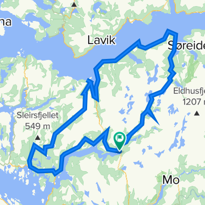
Stølsheimen rundt
A cycling route starting in Mo, Hordaland, Norway.
Overview
About this route
- -:--
- Duration
- 294.2 km
- Distance
- 4,628 m
- Ascent
- 4,628 m
- Descent
- ---
- Avg. speed
- ---
- Max. altitude

Continue with Bikemap
Use, edit, or download this cycling route
You would like to ride Stølsheimen rundt or customize it for your own trip? Here is what you can do with this Bikemap route:
Free features
- Save this route as favorite or in collections
- Copy & plan your own version of this route
- Split it into stages to create a multi-day tour
- Sync your route with Garmin or Wahoo
Premium features
Free trial for 3 days, or one-time payment. More about Bikemap Premium.
- Navigate this route on iOS & Android
- Export a GPX / KML file of this route
- Create your custom printout (try it for free)
- Download this route for offline navigation
Discover more Premium features.
Get Bikemap PremiumFrom our community
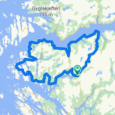
Other popular routes starting in Mo
 BF7 Matre Slovag
- Distance
- 45.2 km
- Ascent
- 1,310 m
- Descent
- 1,690 m
- Location
- Mo, Hordaland, Norway
 BF3 Anleggsveien Stordalen
- Distance
- 10.6 km
- Ascent
- 355 m
- Descent
- 440 m
- Location
- Mo, Hordaland, Norway
 BF4 Anleggsveien Haugsdalen Svartavatnet
- Distance
- 32.5 km
- Ascent
- 2,767 m
- Descent
- 3,227 m
- Location
- Mo, Hordaland, Norway
 Stølsheimen Vest
- Distance
- 152.3 km
- Ascent
- 1,505 m
- Descent
- 1,504 m
- Location
- Mo, Hordaland, Norway
 BF1 Matresdalen
- Distance
- 4.8 km
- Ascent
- 759 m
- Descent
- 499 m
- Location
- Mo, Hordaland, Norway
 BF2 Haugsdalen
- Distance
- 13.5 km
- Ascent
- 2,285 m
- Descent
- 2,285 m
- Location
- Mo, Hordaland, Norway
 Stølsheimen Vest: Fjordsykkelruta
- Distance
- 217.5 km
- Ascent
- 2,041 m
- Descent
- 2,041 m
- Location
- Mo, Hordaland, Norway
 BF6 Matre Solund
- Distance
- 95.4 km
- Ascent
- 1,801 m
- Descent
- 2,181 m
- Location
- Mo, Hordaland, Norway
Open it in the app